


Where does your forecast come from?
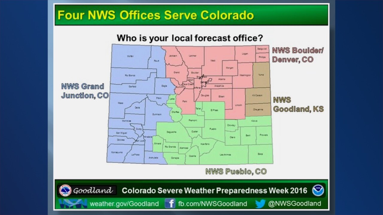
- In northeast Colorado, it’s the National Weather Service office out of Boulder.
- For southeast Colorado, it’s NWS Pueblo.
- The extreme eastern counties – Yuma County, Kit Carson and Cheyenne – are handled by the NWS office out of Goodland, Kansas
- Out west, the folks at the Grand Junction NWS office handle all that forecasting.
Where am I? Here’s a look at the geographical regions of Colorado that we talk about in our weathercasts:

The significance of the Palmer Divide
I’ll give you a little point here on the Palmer Divide. When we have a wind in the cool season that's blowing in from the Northeast, that forces the air to rise up over the Palmer Divide, it drops its moisture and we get some of our heaviest snows on the southwest side of the Denver area, including the Palmer Divide.

That sinking air then comes down into Colorado Springs, so they don't see very much in the way of snowfall at that particular spot.
But in the summertime, if we have southeasterly winds that blow over the Palmer divide, there's something called the “Denver cyclone.” What happens is the air comes down off the divide and it curls back toward the Denver area. If we get thunderstorms that develop in the mountains, they're kind of moving off of the mountains.
They then run into the air coming in from the southeast, and you get what’s called a “convergence line” right over the Denver area from about Castle Rock, through Aurora up to DIA, extending up into Weld County.
Along that convergence line, we can get tornadoes that form because the air coming together starts to spin – and it can also occasionally cause tornadoes that will happen in higher terrain.
RELATED | Colorado weather in-depth: What kinds of tornadoes do we see and how do we spot them?
Most of our tornadoes occur east of Interstate 25. Only about 10 percent occur west of I-25. But they can indeed happen, as you see on this map:

Interested in Colorado weather? Check out Mike Nelson's in-depth explainer of all things severe weather in our state – from where storms begin thousands of miles away, to tracking the storm, to a breakdown of Colorado's peak tornado season.