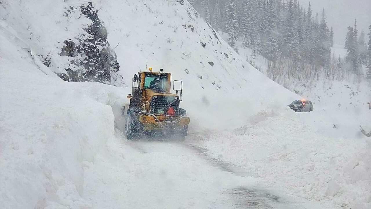


DENVER – U.S. Highway 550 is closed in both directions between Ouray and north of Hermosa because of heavy snow and high avalanche danger and will stay closed until at least Thursday.
The Colorado Department of Transportation closed U.S. 550 at Red Mountain Pass at 6 p.m. Tuesday evening after avalanche mitigation brought down several slides and as heavy snow continued to fall.
The highway was also closed at Coal Bank and Molas passes, south of Silverton, on Wednesday morning.
MORE: Snow totals | Full forecast | Radars | Traffic | Weather Page | 24/7 Weather Stream | 24/7 Radar Stream | Closings and Delays
More than 14 inches of snow has been reported along the stretch of highway as of Wednesday morning. Molas and Coal Bank passes have seen 17 inches of snow, and Red Mountain Pass reported 14 inches Wednesday morning.
“Weather conditions have made public travel impossible, with zero visibility,” Colorado State Patrol Durango said Wednesday. “The two passes received 8-12 inches of snow overnight. Early indications of avalanche danger. Red Mountain Pass also remains closed.”
There is no estimated time of reopening, CDOT said. The area remains under winter storm warnings until 11 a.m. Thursday for another 7-14 inches of snow, according to the National Weather Service in Grand Junction.
The San Juan County Office of Emergency Management said the highway would remain closed overnight, and avalanche mitigation crews were called off the passes for safety.
“An additional 14 inches of snow is expected today, plus another 8-10 inches forecast for tonight,” OEM wrote just after 2 p.m. “Crews are set to conduct avalanche mitigation on all three passes first thing tomorrow morning.”
The Colorado Avalanche Information Center issued avalanche warnings for the Northern and Southern San Juan zones. Avalanche danger is rated as high for Wednesday and Thursday.
“The Sangre de Cristo Range pulled nearly twelve inches of new snow in the last 24 hours, with more to come as slated for the San Juan Mountains as well, where about two feet or more accumulated at some locales since Monday night,” CAIC forecaster Jeremy Yanko wrote Wednesday. “Many observers noted a dust layer accompanied with the onset of the storm, adding to the already complex setup and new slab and old snow interface reactivity.”
Click here for the latest traffic conditions statewide.
