


DENVER – A winter storm will bring snow to much of Colorado starting Friday, with winter storm watches and warnings already in effect and mountain roads likely to see increasing numbers of closures into Sunday morning.
Winter Storm Warnings are in effect for the central and northern mountains through Saturday night, where snowfall could top 2 feet in some places.
In Denver and along the I-25 corridor, between 3 and 8 inches of snow is currently forecast through Sunday, with 6 to 12 inches forecast in the foothills.
Highs will be in the 20s in Denver on Saturday and only in the teens on Sunday, with lows Sunday night dipping near 0 degrees. Mountain temperatures will be similar, with winds in the 10 to 20 mph range that could gust to up to 50 mph in some places.
Below you can find live updates on weather and traffic conditions, along with photos and videos of the storm as it moves through the mountains Friday.
LINKS: Forecast | Radar | Traffic | School closings | Weather Page
1:08 p.m.: US 6 Clear Creek Canyon is closed from Golden to Colorado 119 due to a four-vehicle crash. CSP says injuries do not appear to be serious. The highway is expected to be closed for a couple of hours.
US 6 Clear Creek Canyon closed from Golden to Colo 119 for large crash. 4 vehicles. Thankfully injuries do not appear serious. Probably a couple hours to clean it up.
— CSP Golden (@CSP_Golden) March 1, 2019
S1 pic.twitter.com/hZTMWPI5rB
1 p.m.: Colorado State Patrol says that the person injured in this morning’s crash near Avon was an off-duty Vail fire lieutenant who was on his way to start his shift. He stopped to help other drivers before being struck by another vehicle, CSP says.
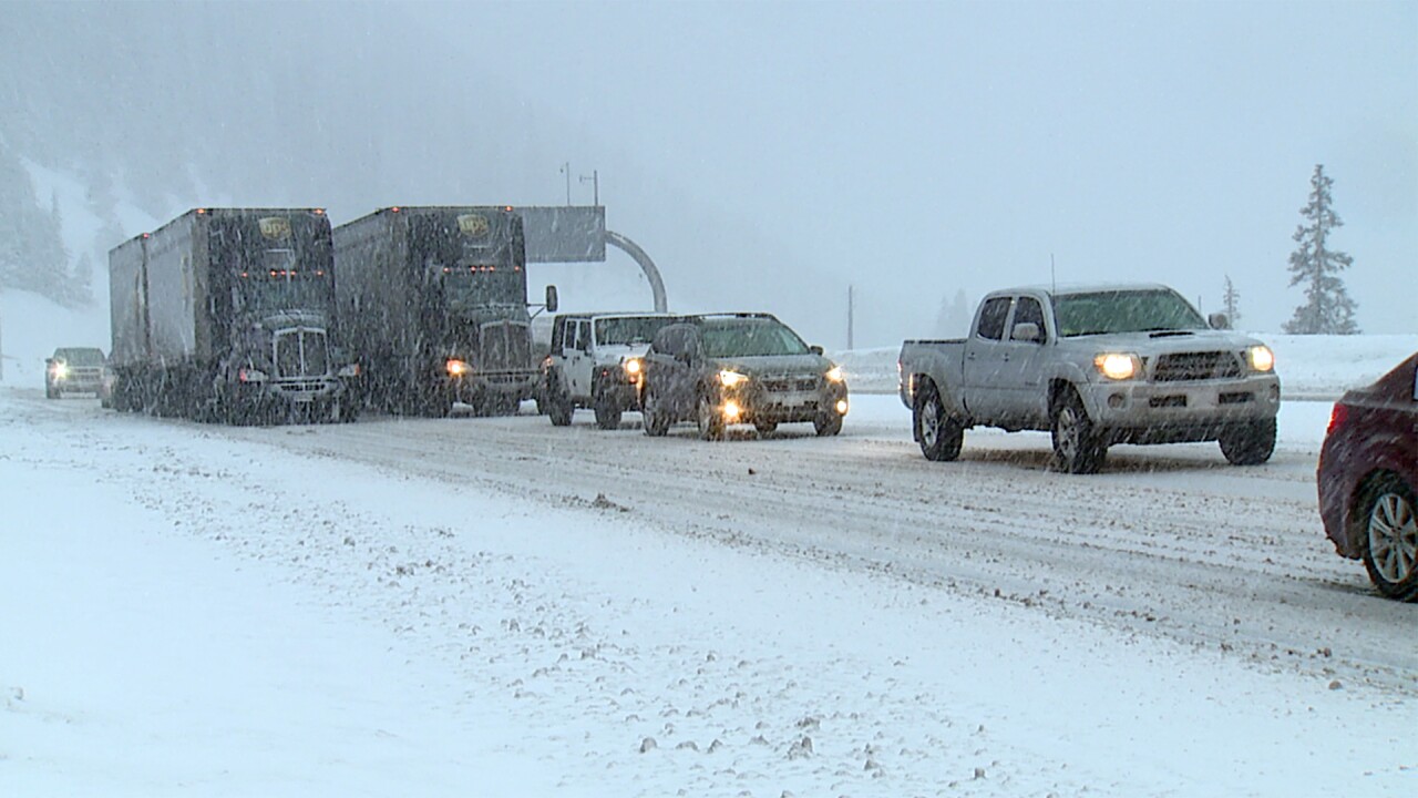
Drive time to the Eisenhower Tunnel from Denver is about an hour and traffic west of the tunnel is moving smoothly.
So traffic was moving very slow. It took us a little over an hour to get here at the Eisenhower Tunnel. @DenverChannel #COWX pic.twitter.com/twHb5ed608
— Tomas Hoppough (@Tomas_Denver7) March 1, 2019
12:21 p.m.: Here is a look at current conditions on I-70 in the High Country from Denver7's Tomas Hoppough.
HAPPENING NOW: lots of traffic — oh and snow. Be careful if you’re heading out to the mountains on I-70 @DenverChannel #COWX pic.twitter.com/Pg7tBNqVXA
— Tomas Hoppough (@Tomas_Denver7) March 1, 2019
11:35 a.m.: The National Weather Service says winds will be out of the west at 15 to 25 mph, with gusts of up to 50 mph. Up to 30 inches of snow are possible at some of the higher mountain elevations.
Current Winter Highlights: Update - Much of Northern CO can expect Snowy & Cold Wx thur the weekend. Conditions will begin to deteriorate over the Front Range FtHills & I-25 Corridor by evening. Expect difficult driving conditions: NE CO & high country thru Sunday morning. #COwx pic.twitter.com/QwZmaMXmdc
— NWS Boulder (@NWSBoulder) March 1, 2019
11:22 a.m.: There are already winter weather advisories, and winter storm watches and warnings in effect for much of Colorado. Click here for the latest weather alerts in your county.
Denver7 Meteorologist Lisa Hidalgo has a few snowfall forecasts through Sunday:
Denver: Flurries late Friday; 1-3 inches into Saturday afternoon with another 3-5 inches possible overnight. Total of 3-8 inches likely through Sunday.
Boulder and Fort Collins areas: Total of 4 to 8 inches expected through Sunday.
Foothills: 6 to 12 inches likely through Sunday
Northern Mountains: Between 1 and 3 feet expected through Sunday
Central Mountains: 6 to 18 inches through Sunday.
10:24 a.m.: Eastbound I-70 reopened after a crash Friday morning just east of Avon in which one person was seriously injured. I-70 was also briefly closed over Vail Pass as snow falls in the High Country.
9:30 a.m.: Loveland Ski Area is closed Friday due to power issues down-line from the ski area. Xcel Energy was forced to turn the power off to the ski area, though Loveland says they plan to be open on Saturday.
