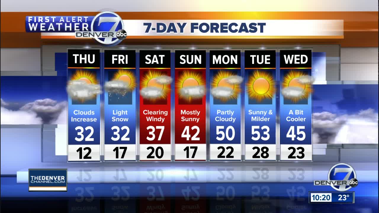

DENVER — A new storm system is moving into Colorado and will spread heavy snow into the central and southwest mountains. High clouds will increase in the Denver area, but the weather will stay dry for now.
A Winter Storm Warning is in effect for the San Juan Mountains through Friday for 1 to 2 feet of snow. This next storm will have little impact on Denver, with just some high clouds expected.
MORE: Live radar | Traffic map | Full forecast
It will be a very cold morning as lows end up in the teens on the plains and zero to 10 above in the mountains.
Temperatures will still be pretty chilly during the day. Highs will be in the low 30s in Denver and across the eastern plains, with 20s to low 30s in the mountains. Snow will increase in the mountains, but dry conditions are expected for the plains.
In the northern mountains, expect more scattered snow showers with highs in the upper 20s to low 30s. Snow will continue heavier over the San Juans and the Sangre de Cristo ranges.
There will be a chance of snow in the Denver metro area Friday through early Saturday. Accumulations will not be heavy, perhaps an inch or so Friday evening with up to three inches over the eastern plains.
Saturday will be windy with clearing skies as the storm moves to the east of Colorado.
Milder and drier weather will finally return to Colorado Sunday through Tuesday.
