

BOULDER, Colo. — The threat of wildfires has been especially front and center in Colorado for months, and projections show the worst could still be ahead as drought conditions worsen. However, firefighters will have a new tool at their fingertips — developed right here in Colorado — that will help them know ahead of time where fires could quickly spread.
Artificial intelligence developed at the National Center for Atmospheric Research (NCAR) in Boulder is allowing scientists to identify the locations and amounts of dead or dying trees and vegetation in Colorado forests, which burn quickly and, therefore, cause wildfires to spread faster.
NCAR scientists behind its development illustrated the technology’s power by retroactively mapping the East Troublesome Fire of 2020, which grew much more explosively than anticipated.
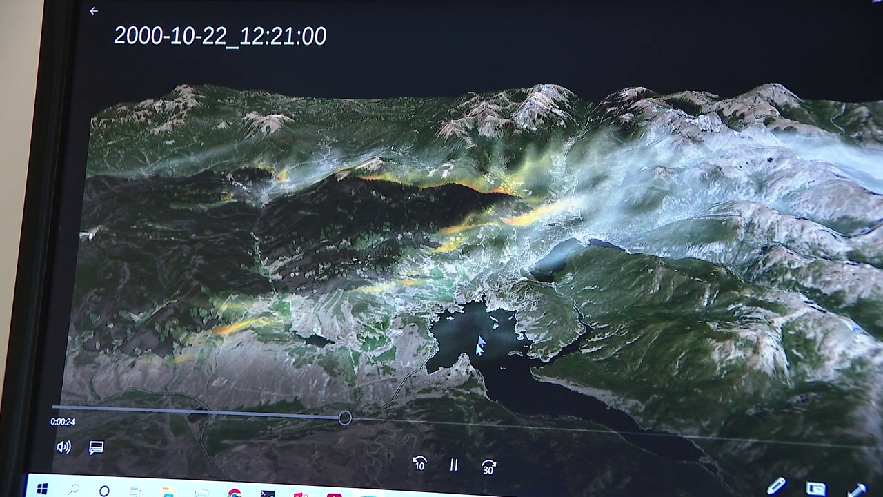
“We can run a simulation, and basically use it to understand how the fire propagates, which areas are burning, and how much smoke is produced by the fire,” said project scientist Timothy Juliano of the East Troublesome Fire projection. “Before this, the fuel map inside of our model didn’t even account for beetle kill. It assumed that the forest was healthy and had live trees that were still standing. In reality, we know that this area was devastated by beetle kill, and a lot of the trees were downed and dead… If we had this product available [then], we would have been able to be much closer to observations in terms of how quickly the fire was going to spread.”
Currently, researchers keep tabs on forest health through a combination of human cataloging and various sets of ecological data. This leads to a laborious process and, at times, unreliable results.
“You can imagine that it takes a lot of time and effort to assemble that data, so it is only published about every five years,” said Amy DeCastro, lead researcher for the study. “Our AI-based method is able to update the vegetation maps during those times between publication and accurately capture any disturbance to the vegetation that may have happened in the meantime, like drought and beetle infestation.”
As Colorado firefighters look forward — and into the prospects of longer and more severe fire seasons — technology that gives a more robust understanding of forest health will better equip them to show up in the right places at the right times. It will provide a head start that could literally save homes and lives.
“We intentionally designed this project around freely available satellite imagery and an online modeling platform,” DeCastro said. “So any firefighter or land manager that wants to update their vegetation data before running wildland fire forecast has access to this method.”
“They can put out their evacuation warnings faster, and just have a better sense of where the fire will be and at what time,” Juliano said.
The team at NCAR has been working on this artificial intelligence for more than a year, and knew early on of its potential power. It was in December, however, that its impact truly sank in for Juliano, as he was forced to evacuate his home in Louisville during the Marshall Fire.
“I think for me, it’s like extra motivation, honestly, just to be really passionate about the research and try to resolve some of these issues,” he said. “It hits home when you see it firsthand.”
