


DENVER — Rain and hail dumped across Colorado Wednesday night, leading to some flooding and piles of pebble-sized hail shutting down an Estes Park road.
It looked like a winter wonderland on a stretch of Elkhorn Avenue in Estes Park late Wednesday night after the hail piled into the street, making the road impassable for a period of time, according to the Estes Park Police Department.
Community members helped dig cars out and clear the street by Thursday morning, but the piles still remained on the sidewalks. A plow had to come in to clear it all out.
A plow is here to get the hail off the sidewalk in Estes Park @DenverChannel it really looks like winter! Wow! pic.twitter.com/drba6goDcZ
— Jessica Crawford, Esq. 🇺🇸 (@jcrawfordtv) July 28, 2022
Denver7 meteorologist Lisa Hidalgo said the “perfect ingredients” were in place to make it happen. She said it was a combination of an unstable atmosphere, additional lift due to the jet stream and a lot of moisture in the air because of a strong monsoon flow — which basically means there was very moist air being lifted above freezing level which allowed all of the hail to form.
THURSDAY'S FORECAST: Flooding rain, hail possible across Colorado Thursday afternoon
Much larger hail was also reported across the state, according to the National Weather Service. Hail was reported in Washington, Douglas, Boulder, Larimer and Weld counties ranging from an inch to up to 2.25 inches. Winds gusted up to 66 mph in Jefferson County and 60 mph in Douglas County. Several inches of rain reportedly were flowing across Highway 61 at County Road 51 in Washington County, more than 2 inches of rain fell in Boulder County and a half-inch of rain dumped in Larimer County in just 15 minutes.
All of that rainfall led to flooding and mudslides in Ouray County, which caused County Road 361 to close at the Thistledown campground area, according to the Ouray County Sheriff’s Office. The sheriff’s office said bridge crews will come out Thursday morning to continue clearing debris. The road was damaged in multiple sections, the sheriff's office said on Thursday, and it likely won't reopen until Monday.
The rain also impacted the Grizzly Creek, Cameron Peak and Four Mile burn scar areas. A flash flood warning was issued by the NWS for the Glen Haven, Storm Mountain and Retreat areas and the Gold Hill and Wallstreet areas. In Glenwood Canyon, I-70 was impacted with temporary closures for the Canyon bike path and Grizzly Creek and Bair Ranch rest areas that have since reopened, according to the Colorado Department of Transportation.
Xcel Energy also reported more than 3,700 customers without power last night, but nearly all were resolved by Thursday morning.
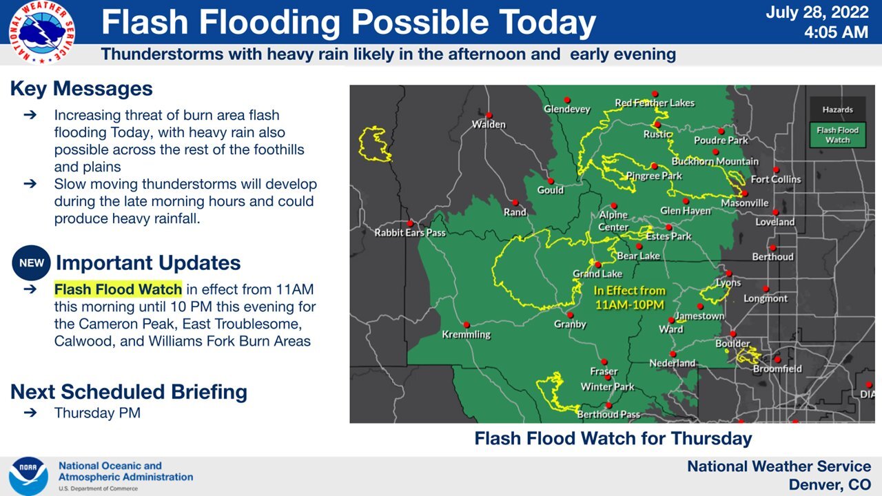
After two evenings of active weather, relief is not quite yet in sight. More rain and hail are possible Thursday afternoon, and the NWS Boulder said there’s an increased threat of flash flooding in the burn scars. Several areas across the state are under a flash flood watch.
You can always watch 24/7 weather, radar and news updates on the free Denver7+ app on your TV.