


The National Weather Service is issuing several tornado warnings across the eastern plains.
Severe thunderstorms watches are also in effect for the entire northeast corner of Colorado, plus the Front Range. This applies to the following 12 counties: Elbert, Lincoln, Adams, Douglas, Phillips, Weld, Arapahoe, Logan, Sedgwick, Denver, Morgan and Washington.

This severe thunderstorm watch is in effect until 9 p.m. Wednesday.
Below is the latest on Colorado's tornado warnings. Click here for Denver7's interactive weather radars.
5:23 p.m. | The tornado warning in Morgan County has been allowed to expire as the National Weather Service says that cell is no longer currently capable of producing a tornado. Here's a look at current radar conditions.
Thunderstorms over northeast Colorado. #cowx pic.twitter.com/UluHVpMPlS
— NWS Boulder (@NWSBoulder) July 6, 2022
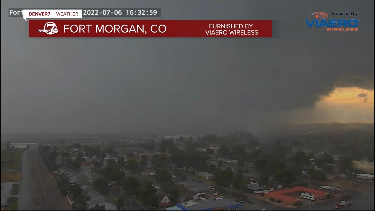
4:44 p.m. | A tornado warning was extended for Fort Morgan and Log Lane Village in Morgan County until 5:15 p.m. A radar indicated the possibility of a tornado. This warning covers a population of about 23,000 people. Hail the size of a quarter is possible. UPDATE: This was extended to 5:30 p.m.
4:11 p.m. | The NWS said a tornado warning is in effect for Elbert County until 4:30 p.m.
——— Original story below ———
The National Weather Service has issued a tornado warning for Lincoln County until 4:15 p.m. and western Morgan County until 4:30 p.m.
A weather radar indicated rotation in these storms, which may lead to a tornado, the NWS said.
In addition, hail up to 2 inches in diameter is possible in Lincoln County and up to a half dollar size in Morgan County.
The Lincoln County warning includes the unincorporated community of Boyero. The Morgan County one includes Goodrich and Weldona.
Previously, the NWS issued a tornado warning for northwestern Elbert County and south-central Arapahoe County, which expired at 3:30 p.m.
At 3:06 p.m. Wednesday, a severe thunderstorm was located about 30 miles east of Denver and 11 miles south of Bennett. It was moving north around 20 mph and was capable of producing a tornado and golf ball-sized hail, according to NWS. A radar indicated that the storm is rotating, but a tornado was not confirmed, NWS reported.
The storm remained over mostly rural areas.
NWS warns that in the case of a tornado warning, anybody outside should take shelter as the winds will likely pick up debris. There's also a danger to mobile homes, roofs, windows, vehicles and trees.
Anybody in this area should move to an interior room or basement of a sturdy building. Avoid all windows. If you're outside, in a mobile home or in a car, move to the nearest shelter and protect yourself from debris.
