


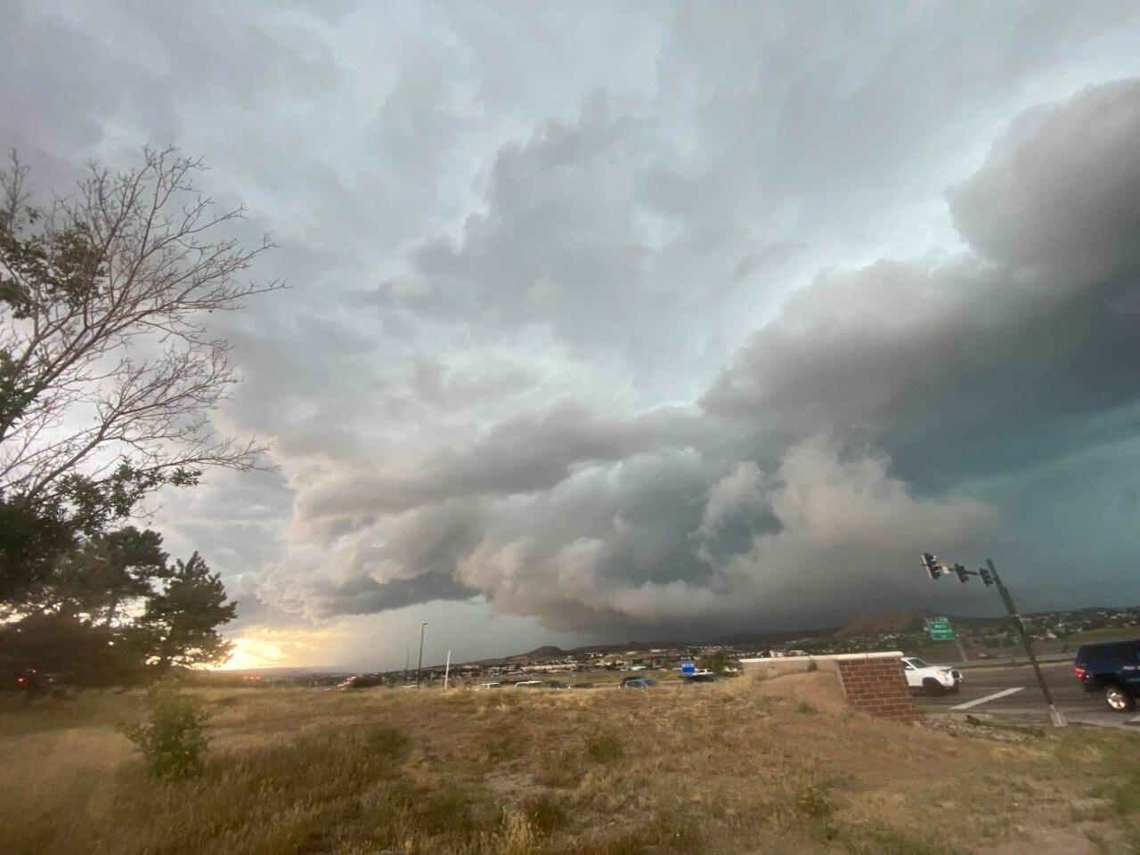
Scattered and slow-moving storms will increase the risk of flash floods for parts of Colorado beginning Monday afternoon through Tuesday.
Monday morning's sunshine and temperatures in the 80s gave way to scattered and slow-moving storms that lasted into the evening. Tuesday morning and afternoon also brought more precipitation.
Denver7 will update this blog with the latest on this storm's movements.
MORE: Rain totals | Today's forecast | Interactive radars | Current conditions | Weather alerts
Tuesday, Aug. 16
3:42 p.m. | FLASH FLOOD WARNING | A flash flood warning is in effect until 8 p.m. for Garfield and Mesa counties.
2:24 p.m. | UPDATE ON HIGHWAY 6 NEAR EAGLE-VAIL | US 6 was closed overnight due to water damage on the road between Eagle-Vail and Dowd Junction. Crews are continuing to monitor the road and to ensure it is safe for travel. If it is, CDOT will open the roadway again.
Crews are using strength testing technology and other methods to test the road.
Early Tuesday, crews observed that the swelling that as evident Monday was no longer visible.
CDOT will use a deflectometer, but it is not available until Wednesday.
11:31 a.m. | ROAD BACK OPEN | Spader Way has reopened from 1st Avenue to DesCombes Drive, Broomfield police said, following street flooding from heavy rain.
10:22 a.m. | BROOMFIELD RAINFALL | About a quarter of the average yearly precipitation in Broomfield fell in just a few hours Tuesday morning, according to the National Weather Service. Read the full story here.
9:35 a.m. | BOULDER COUNTY BIKE PARK CLOSED | Boulder Parks and Recreation has closed the Valmont Bike Park due to flooding.
8:39 a.m. | FLOODING IN BROOMFIELD | The Broomfield Police Department is reporting flooding in some parts of the city. Spader Way is closed from 1st Avenue to DesCombes Drive because of street flooding from heavy rain. There's also fast-moving water in Midway Park. Officials remind the community to avoid flooded areas and look for alternative routes.
This is a look at Midway Park in @broomfield. Water is running fast. Please use caution and avoid areas experiencing flash flooding. The water is deeper than you may think. pic.twitter.com/5cwHYgj9Wa
— Broomfield Police (@BroomfieldPD) August 16, 2022
8:37 a.m. | RAIN TOTALS AS OF MONDAY EVENING | The NWS Boulder issued rainfall reports late Monday evening, with more than two inches of rain falling in Aurora.
Heaviest rain earlier today fell from the Palmer Divide into the southeast portions of the Denver metro area including Aurora. Locally heavy rain also occurred in the foothills. Check out some of these storm totals, most of this falling in less than 45 minutes. #COwx pic.twitter.com/ckvpfvH0rQ
— NWS Boulder (@NWSBoulder) August 16, 2022
Monday, Aug. 15
8:35 p.m. | HIGHWAY REOPENED | I-70 between Glenwood Springs and Dotsero is back open.
6:04 p.m. | STREET FLOODING | Street flooding at Quincy and Parker in Aurora caused several accidents and made the intersection impassible. Police are on scene and have closed the area to traffic.

5:23 p.m. | FLASH FLOOD WARNING | The Basalt Mountain and Lake Christine Fire burn area are under a flash flood warning until 7:15 p.m., according to the Pitkin County Regional Dispatch Center.
5:18 p.m. | HIGHWAY CLOSURE | I-70 is completely shutdown between Glenwood Springs and Dotsero due to a flash flood warning. The interstate will remain closed until the flash flood warning is lifted, which is expected to end at 8 p.m., according to CDOT. The closure could be extended if the warning continues or if a flash flood occurs.
5:06 p.m. | FLASH FLOOD WARNING | Parts of Eagle County and Garfield County around I-70 are under a flash flood warning until 8 p.m.
4:59 p.m. | FLASH FLOOD WARNING | A flash flood warning is now in effect for communities north of Peyton in El Paso County until 8 p.m.
4:30 p.m. | ROAD REOPEN | Highway 34 and County Road 43 in Larimer County have both reopened, according to the sheriff's office. Streamside Drive remains closed at CR 43.
4:24 p.m. | WATER DAMAGE ON ROAD | Colorado Department of Transportation crews are investigating water damage on US 6 between Eagle-Vail and Dowd Canyon. The highway is closed due to "accelerating damage to the roadway at Mile Point 173.8," CDOT said. In an update, the department said the highway will remain closed overnight.
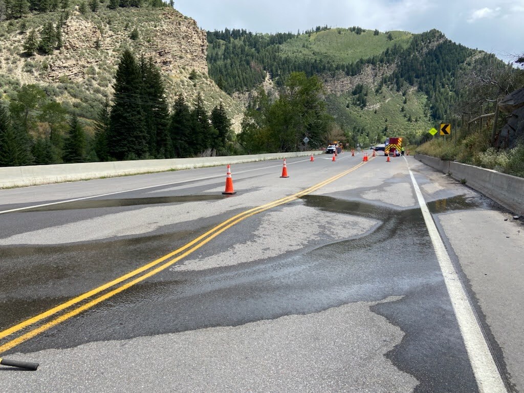
Crews are working to find where the water is coming from and how to repair the damage.
Drivers should use I-70 as an alternate route.
4:21 p.m. | ROAD CLOSURE | The Aurora Police Department said the intersections of Parker and Quincy, and Dartmouth and Chambers are both flooding. The water on the road is making it impassible, police said. There are multiple crashes due to the conditions.
4:08 p.m. | ROAD CLOSURE | County Road 106 in Elbert County is closed beginning at County Road 13 and continuing west to about two miles east of County Road 5. This does not impact any addresses, but drivers will need to find alternate routes, according to the county's office of emergency management.
4:08 p.m. | DELAYED RELEASE FROM SCHOOL | Cherry Creek Schools said it is holding 6th-9th students for a delayed release. Elementary students already left for the day. Parents can go to the school to pick up their children, but there are no bus services.
4 p.m. | FLASH FLOOD WARNING | A flash flood warning has been issued for part of El Paso County west of Peyton until 7 p.m.
3:52 p.m. | LONE TREE UPDATE | The City of Lone Tree says street flooding is occurring around the city, including Park Meadows Drive between Yosemite and Acres Garden. A severe thunderstorm warning is in effect here until 6:15 p.m. Winds may reach 60 mph with one-inch hail.
3:52 p.m. | SEVERE THUNDERSTORM WARNING | A severe thunderstorm warning covers Strasburg, Bennett, and Watkins until 4:30 p.m. This storm has 70 mph wind gusts.
3:47 p.m. | FLASH FLOOD WARNING | A flash flood warning for Centennial, Parker and Foxfield is in place until 6:45 p.m.
What do the skies look like in your neighborhood right now? This is a timelapse of the storm as it moved over Centennial a short time ago. (📹: Martin Herrera)
— Denver7 News (@DenverChannel) August 15, 2022
Latest updates: https://t.co/EEUvLOT8Md #COwx pic.twitter.com/RO8a6LtKbF
3:37 p.m. | IMPACTS IN PARKER | Parker police say 60 mph winds and quarter-sized hail has been reported in the town. Residents may see damage to roofs, cars, house sidings and trees.
3:28 p.m. | SEVERE THUNDERSTORM WARNING | A severe thunderstorm warning has been issued until 4:15 p.m. for Centennial, Castle Rock and Parker. This warning effects almost 700,000 people.
3:26 p.m. | FLASH FLOOD WARNING | A flash flood warning is in effect until 6:30 p.m. for Cortez.
3:16 p.m. | FLASH FLOOD WARNING | The NWS has issued a flash flood warning for part of Douglas County, including Castle Pines, Lone Tree, Louviers and Sedalia until 6:15 p.m. This warning impacts about 163,000 people.
The NWS said rainfall rates in Douglas County are 1-2 inches in 15 minutes.
This is a quick time-lapse from our roof in downtown #Denver looking southwest towards Jefferson County. Strong storms moving through Castle Rock and Centennial right now, moving east. #Denver7 pic.twitter.com/BA5nbv5SHd
— James Dougherty (@DoughertyKMGH) August 15, 2022
3:12 p.m. | FLASH FLOOD WARNING | A flash flood warning will continue for the area around De Beque on the western slope until 4 p.m., according to the NWS.
3 p.m. | DANGEROUS FLOODING IN GLEN HAVEN | The Estes Park Emergency Communications Center says "dangerous flooding" is happening around Glen Haven, including County Road 43 to Drake.
The Larimer County Sheriff's Office said it has not received any reports of injuries or damage as of now. Water is over the road on County Road 43.
2:42 p.m. | ROAD CLOSURE | Highway 34 westbound is now closed at mile point 85 just west of Loveland due to "safety concerns" amid storms. The closure is between County Road 27 and County Road 29. In addition, Highway 34 eastbound is closed between Dy Gulch Road and Forest Service Road 4031.
2:27 p.m. | DANGEROUS FLOODING IN ESTES PARK | The Estes Park Emergency Communications Center says dangerous flooding is happening around Streamside Drive northeast of Estes Park and Glen Haven. Residents should seek higher ground now.
2:15 p.m. | FLASH FLOOD WARNING | The Larimer County Sheriff's Office has issued a flash flood warning for the Glen Haven, Drake and Cedar Cove area due to a storm cell that has produced "periodic surges of water" around the community. Residents may need to leave or climb to a higher location if conditions worse, the sheriff's office said. The NWS said Drake is seeing rainfall rates of about 2.5 inches per hour.

This flash flood warning is in effect until 5:30 p.m. Monday and includes The Retreat, Miller Fork, and Black Creek. It also includes Highway 24 between Estes Park and Loveland.
1:56 p.m. | NE COLORADO FLOOD THREATS | Eastern Washington and Yuma counties have an increased likelihood for heavy rainfall overnight, according to the Colorado Water Conservation Board's Colorado Flood Threat Bulletin. Local totals may reach 5 inches.
1:45 p.m. | RED CROSS READY | The American Red Cross of Colorado and Wyoming said it is monitoring the flood threats today and has volunteers ready to help if its government partners request it.
12:30 p.m. | CURRENT FORECAST | Long periods of rain on Monday will increase the risk of flash floods for parts of eastern Colorado, including recent burn scar areas and the Front Range, the National Weather Service forecasted Monday morning.
Two flood watches are currently in effect:
- Front Range, Park County and Palmer Divide — including the burn scars for the Cameron Peak Fire, CalWood Fire, Williams Fork Fire, and northeastern portions of East Troublesome Fire — from 1 p.m. to midnight
- Fremont, Teller, Lake, Chaffee, and El Paso counties from 1 p.m. until midnight
At the maximum, one-hour rain rates may reach 2.5 inches and three-hour rain rates may reach close to 3.5 inches in some spots. Flooding is possible in urban locations, including low-lying areas, roads, gulches and small streams. In higher terrain, mudflows and debris slides are likely, according to the Colorado Water Conservation Board's Colorado Flood Threat Bulletin released Monday.
Colorado's burn scars may be impacted by these heavy rains.