DENVER — Spring snow is on the way for Colorado's Front Range — but how much accumulation we'll see could vary over the next few days.
Snow was beginning to fall in the Denver area around 3 p.m. Thursday. The National Weather Service in Boulder earlier Thursday was calling for 5 inches of snow in Denver, with higher amounts into the foothills and mountains. But as we often see in spring storms, how much snow we get could depend on the temperatures and whether the precipitation falls as rain or snow. Also, the prospect of thunderstorms could lead to heavier snow in localized areas.

Another factor, according to the Weather Service, is whether precipitation develops earlier on Wednesday night, leading to snowfall in some areas. But for now, the precipitation would likely be on the lighter side until later in the week.
We do know this: We're likely in for several days of soggy, cool weather, beginning Thursday, when showers are expected to move into the area.
Temperatures could drop enough to begin producing snow by Thursday afternoon. The heaviest of the snow should clear out of the area by Friday, and travel impacts aren't expected to be severe due to the April sun angle and temperatures nearing 40 on Friday.
One thing to keep in mind heading into the weekend are the expected low temperatures on Sunday morning. Temps could drop into the teens across the metro area.
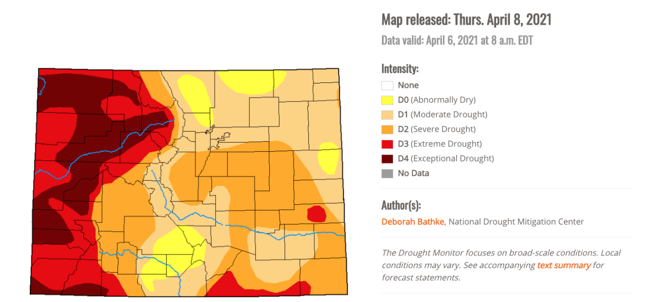
The stretch of rain and snow is much-needed across Colorado, as most of the state remains in drought conditions. Southern areas of the metro and into the southeast plains are in severe drought conditions, and much of the Western Slope is under extreme or exceptional drought conditions.