


Many of Colorado's trails wind through spectacular sites — hidden waterfalls, rocky peaks, dramatic ridge lines. But dotted along these Rocky Mountain paths is another scene that holds a different kind of emotion: plane crashes.
These sites are frozen in time, telling silent stories of violent wrecks that now, dozens of years later, are surrounded by hushed forests and relatively few human visitors. Soft, leafy plants have curled around the jagged and crumpled pieces of metal and saplings are slowly replacing the mature trees destroyed all those years ago.
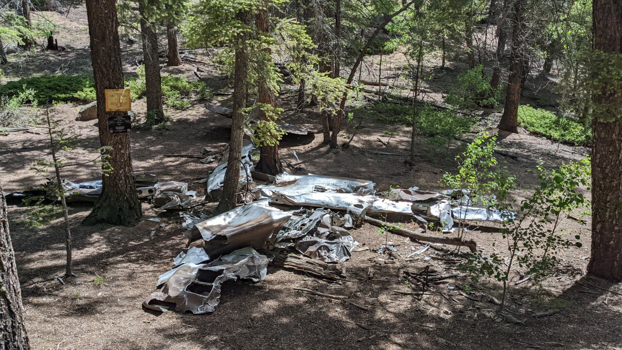
Hikers may see a remembrance sign with brief details at some of the wrecks, but the full stories remain mostly tucked away in the fading folds of history.
Unless you seek it out.
So, hello reader.
In Denver7's research below, we brush off the cobwebs to uncover the historical context behind each crash, what went wrong and the people who perished, so those who visit in the future can better appreciate what happened.
(Note: The locations in the embedded map below are estimates and the actual crash site may be slightly different.)
A brief overview of hikes to plane crash in Colorado
Ask around for an expert on aviation history and archaeology in Colorado and many people will point you to Brian Richardson.
As both the safety program manager at the Federal Aviation Administration and archaeology volunteer with Colorado Aviation Historical Society, Richardson has been involved in aviation for all of his adult life. He's one of roughly 400 people who are actively involved in aviation archaeology in the United States.
Many of the featured crashes in this story are from World War II, when wrecks during training missions were almost a constant in the Rocky Mountains.
"The skies were very crowded," Richardson said, noting a lot of heavy bomber training in the state. "There were actually 11 airfields in the state of Colorado that had military flying activities going on at them.... As far as the technology of the aircraft, they were definitely a little more primitive than we have today."
Still, during the war, the planes' engines and structures were relatively reliable, given the time. But the same couldn't be said for all pilots, many of whom were very young and hastily trained when they first sat in the pilot's seat.
"You have to understand that in 1941, when the war started, we had a total of 9,000 pilots in the Army Air Forces at that time," he said. "By 1943, we had over 165,000 that had gone through primary flight training in this country. In 1943, by the way, was the worst year for accidents in the United States for all the military branches. They were just literally falling out of the sky, so to speak."
Colorado's weather didn't help much. Pilots in WWII used Morse code signals, which were interrupted or hard to hear in storms due to the moisture in the air, Richardson explained.
While the state sees roughly 320 "good days of flying weather," poor conditions — back in the 1940s or today — can create intense and dangerous situations for pilots, he said.
When an aircraft did go down, search and rescuers would first make an effort to determine exactly where the crash was and then search the area by air and foot. They'd recover any human remains, personal possessions, and weapons that they could, but crashes around or above 10,000 feet were typically left on the mountain.
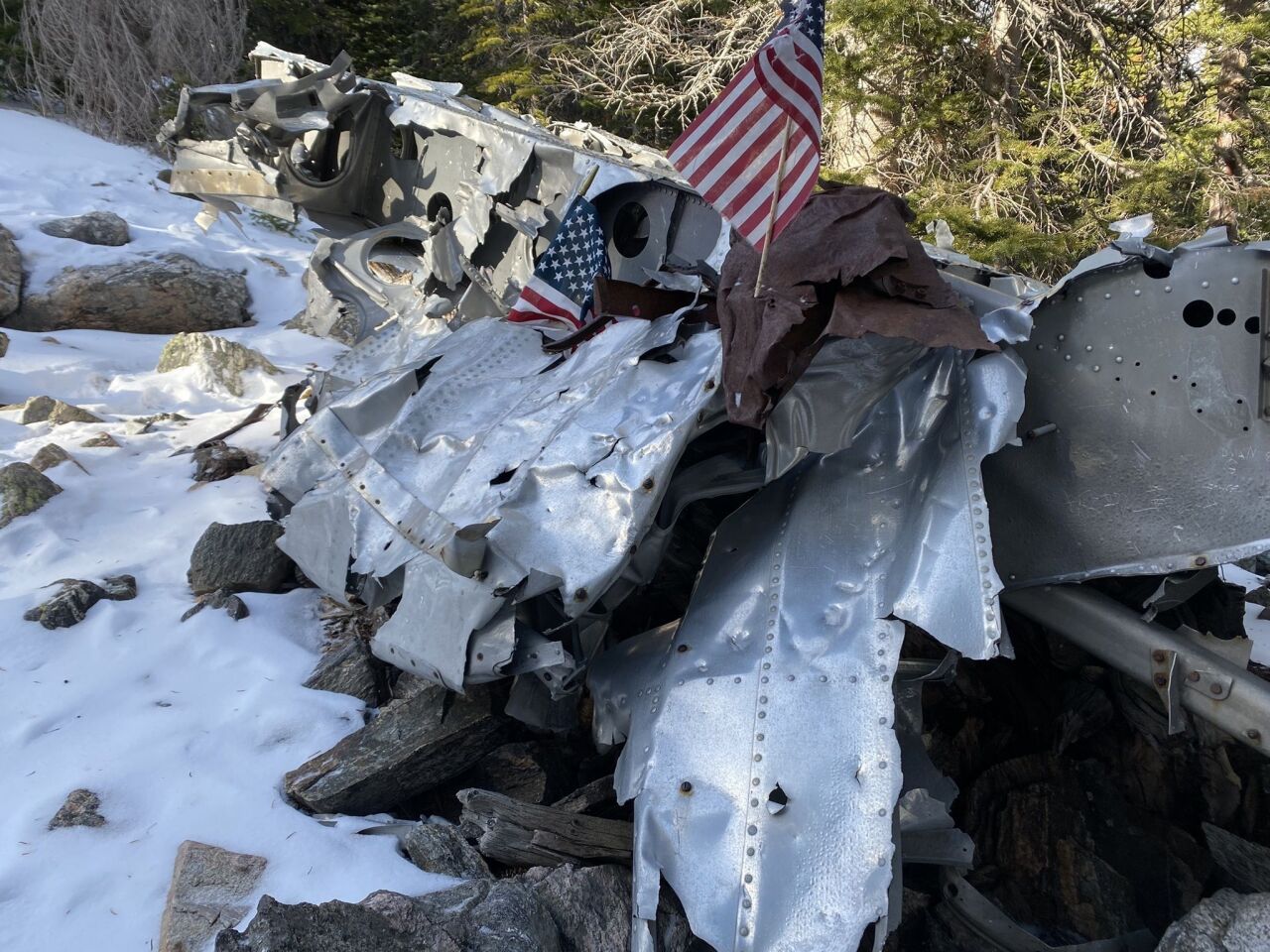
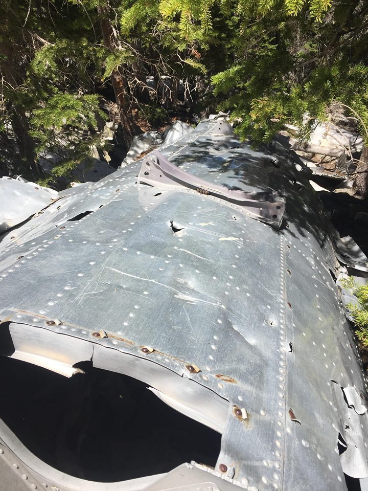
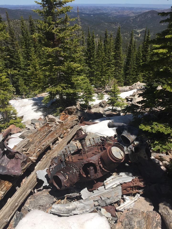
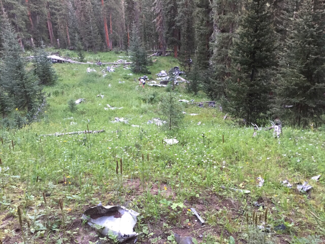
"You're not going to go to an aircraft crash in the mountains and find a complete airplane," Richardson said. "That just doesn't happen out here. What you will find is maybe a lot of airplane there, but it doesn't look like one much anymore. And of course, the souvenir hunters have really picked them over very well over the years. Most of these sites have been pretty well cleaned up."
Richardson said these scavengers are expediting the sites' disappearances.
"The first thing I’d like to remind everybody is that many, many, many of these crash sites are actually graves," he said. "Most of the human remains were removed. That doesn't mean it's always been that way. But please treat them with reverence and respect. Also, if every person that visits these sites decides to take home a souvenir, pretty soon the site is going to vanish completely. And most people take souvenirs home and after a while they lose interest and they end up in the trash. We'd much rather see them left in place so that everybody else can enjoy it down the road."
"But the bottom line is these sites are starting to disappear at a pretty phenomenal rate, the ones that are still in the wild," Richardson said. "Please, treat them with respect. If you need a souvenir, take a photograph."
A few quick reminders:
- Be respectful of the sites
- It is illegal to remove or vandalize any pieces. Violators will be fined. Some sites may have security surveillance. Report anybody you see stealing from the sites
- All of the featured crash sites below are on public land with established trails or social (though possibly unmaintained) trails. Never use private property as a shortcut
- Consider leaving your dog at home, as many sites are covered in shrapnel (some that are very small and extremely sharp)
- As with any hike, bring or download maps to use in case you lose cell service, food, water and proper attire for changing weather conditions
Feb. 23, 1943 | C-49J crash near Blodgett Peak
Around noon in late February 1943, three men took off in an army cargo plane from the Pueblo base bound for Lowry Field in Denver, but it never arrived at its destination. On the morning of Feb. 23, the plane was reported missing and had presumably gone down in central Colorado in an area of dense fog, according to The Daily Sentinel.
At least 25 people searched around Colorado Springs and Palmer Lake for the downed airplane and the three men, but they didn't find the scene until a few days later on March 1. A schoolboy tipped off authorities after he said he heard a loud explosion on the afternoon of Feb. 23.

After three hours of hiking up to the mountain ridge, searchers found the scene.
“The wreckage of an army cargo plane, strewn over a wide area near the crest of a tree-covered mountainside, was surveyed by officials today," The Daily Sentinel wrote that day, adding that an official called the scene "of almost indescribable destruction."
Searchers found a motor of the plane about a quarter mile from the crash. Officials said the three men had died instantly.
A guard stood at the scene overnight.
The men's bodies were recovered on March 2 by 25 soldiers from the then-Peterson Air Force Base.
Known deaths: Baxter L. Ireland (pilot), Francis Clark, Stancil Bolling
How to get to the site: Anybody trying to find this crash site should be aware that it is a difficult hike in scree-filled steep terrain that requires wayfinding. It is arguably the most challenging one to reach on this list. Blodgett Open Space says that simply accessing Blodgett Peak can be treacherous, and that injuries and fatalities have occurred. There is no designated trail to the summit or beyond, however there is a social trail. Click here for a map of the maintained trails in the open space — the trail to Blodgett Peak goes off-screen in the upper left corner. Parking is available at the North Blodgett Trailhead (3786 W. Woodmen Road).
Sources: The Daily Sentinel (Feb. 24, 1943 + Feb. 27, 1943 + March 1, 1943 + March 2, 1943), Greeley Daily Tribune (March 1, 1943)
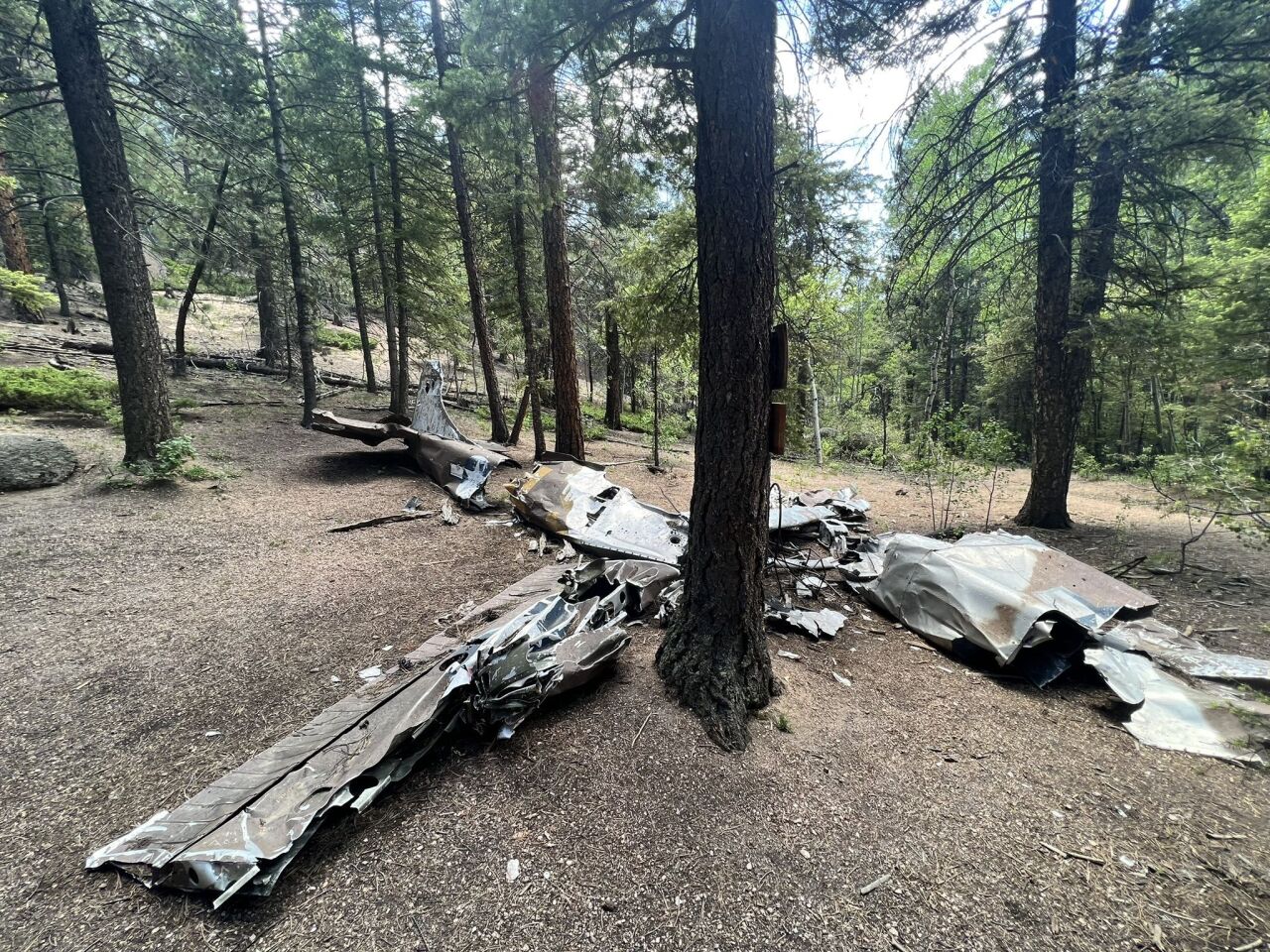
July 19, 1943 | B-24 bomber crash near Taylor Park in Gunnison County
As rescue crews worked around a B-24 crash about 21 miles northeast of Gunnison on a July afternoon in 1943, they found incredible destruction, but also a wristwatch, frozen at 11:52 a.m.
Officials later said this marked "the hour of sacrifice for 11 American freedom fighters and their surviving families," according to a sign at the site.
The heavy bomber had been on a World War II training mission from Wyoming to El Paso, Texas when it plummeted from the sky and crashed on a hillside about 800 feet above the Taylor River in Gunnison County. The sign says the B-24 "spun out of the clouds and crashed and burned in Taylor Canyon, a rugged, forested area about 25 miles northeast of Gunnison. Structural failure of the tail surfaces either caused complete loss of control or the abrupt pull-out from the initial dive may have caused the failure."
Witnesses claimed to see the aircraft break apart in mid-air, the Fort Collins Coloradoan reported a day after the wreck. A fisherman told The Greeley Daily Tribune it spiraled "out of the clouds."
Eleven men died upon impact. The area is now considered a funerary site because "the crash severity and fire resulted in partial interment of the body of one or more crew members," according to the Gunnison County website. It sits a couple hundred feet off a Forest Service road.
Known deaths: Sherod D. Derryberry (pilot), James H. Allen, William M. Statler, Billy B. Thompson, Robert C. Quine, Romeo P. Berube, J. W. Beazley, James F. Emerich, Rocci A. Greco, Richard D. Yost, Richard E. Schaefer
How to get to the site: From Gunnison, head north on Colorado Highway 135. About 10 miles out of town, turn right onto County Road 742 and cross over the river. Continue past the small unincorporated community of Almont. You will find a pulloff on the westbound side of the road after 14.5 miles. You can park there and then cross the street to find a stack of rocks and tape around trees. Follow the tape about 200 feet up to the crash site. Be aware that it is a brief, but steep climb and you may need to use your hands.
Sources: Sign at the crash site, Fort Collins Coloradoan (July 20, 1943), Greeley Daily Tribune (July 20, 1943)
Oct. 18, 1943 | B-17 crash at Pingree Park and Stormy Peaks
Late on the evening of Oct. 18, 1943, a concerned couple drove the roads around their ranch about 20 miles west of Fort Collins after hearing an explosion. Their search was unsuccessful, but they knew they had heard some sort of violent crash in the mountains around Pingree Park.
They, among others, found out the following day that a B-17 bomber and its full crew was missing in the area, according to the Fort Collins Coloradoan from that day.
Around 5 a.m. on Oct. 20, after a day of snowfall, rescuers headed out to the Mummy Range to try to find the crash. They'd later learn that two ranchers in the area had followed scouting planes the day prior and already stumbled across the crash debris, where they found five bodies.
When park rangers, Lowry Field officers, and a coroner reached the crash — after fighting freezing wind and snow squalls that pummeled the Roosevelt National Forest — they counted eight deceased Army fliers, including one from Colorado: Sgt. Philip Doddridge of Kirk of Yuma County.

In the following investigation, authorities determined the B-17 had been en route to Denver from Rapid City, South Dakota. The aircraft was pointed south when it crashed “with a violent explosion” about 1/8 of a mile north of the Rocky Mountain National Park boundary at an elevation of about 11,000 feet, according to the Fort Collins Coloradoan. Most of the plane, which had been blasted apart, was melted and only the tail remained intact. The crash sparked a small wildfire, which was contained to about 1.5 acres.
About six months after the crash, the Estes Park Trail reported that under that fateful day's overcast sky, the crew did not know the mountain was in their path.
As of 2000, the City of Fort Collins said all four engines are still in the mountains.
Known deaths: Philip Doddridge, Richard Creamer, Joseph R. Arnold Jr., Warren M. Dean, Andrew H. Christensen, William N. Cook, Robert J Hopkin, Carl E Hamre
How to get to the site: Park on the Colorado State University Mountain Campus's Stormy Peaks Trailhead if you're able to (but you can access the trail from any parking lot on the campus). Jump on Stormy Peaks Trail and head south. When you get to a sign for Twin Lakes (about a half mile in), follow it by making a left onto Twin Lakes Reservoir Trail. Continue south along the west side of the reservoir. The trail, which turns into Old Sawmill Trail, mostly follows the Twin Lakes Canal. After a creek crossing, continue along the trail southeast to the crash site. Around the 2.5-mile mark, you'll see a trail on the left, but continue straight. The trail is about 5-6 miles out and back. See a trail map on AllTrails.
Sources: Greeley Daily Tribune (Oct. 20, 1943), Fort Collins Coloradoan (Oct. 19, 1943 + Oct. 21, 1943 + Oct. 24, 1943), Estes Park Trail, (April 28, 1944)
June 13, 1944 | B-17 crash near Crown Point and Flowers Road
Dazed and injured, Sgt. Don Jacobs, an engineer, and Cpl. Leroy Faigin, a waist gunner, walked away from a plane crash around 5 a.m. on June 14, 1944. Just before midnight, their B-17 that had been soaring above the Crown Point area, west of Fort Collins, dipped and crashed into the mountainside.
Jacobs and Faigin's desperate search for help lasted 14 hours.
The duo last ate around noon the day prior and would eventually go 30 hours without food. At 7 p.m. the day of the crash — more than 12 hours after the plane went down — they hailed two fishermen from Ault who brought the injured men to Ted's Place for food, the Fort Collins Coloradoan and Greeley Daily Tribune reported.
After a warm meal, the fliers were brought to the Larimer County Sheriff's Office, where they explained the horror of the previous evening.
The crew had set out in the B-17 on the afternoon of June 13 from Rapid City, South Dakota with plans to practice flying in a circle over Wyoming, before heading south to Akron, Colorado then over Scottsbluff, Nebraska. At one point over Colorado, a crew member noted that the altimeter read just 10,200 feet and he could see trees outside the windows. He said they needed to get higher. As the pilot began to point the plane's nose up, the aircraft crashed into trees, according to the Fort Collins Coloradoan.
Jacobs and Faigin reported that the pilot, co-pilot and navigator had definitely died in either the crash and the subsequent explosion. Despite the injuries of the other surviving crew members, all but one ran from the aircraft. Jacobs and Faigin said they dragged the lone man — a tail gunner who had injuries to his legs and head — a short distance away. They told the sheriff's office that the tail gunner had likely died, given his condition when they left to seek help. The group built a fire and melted snow for water while Jacobs and Faigin set out into the wilderness and waist-deep snow, according to the Fort Collins Coloradoan.
At the sheriff's office, the airmen attempted to describe where they had traveled and where the plane had crashed, which led authorities to determine the crash was north of Crown Point “in the midst of mountainous country which stockmen who run cattle in the area know familiarly as ‘Hell’s Half-Acre,'" the newspaper reported. It seemed that the injured men had traveled 10 miles during their trek.
On June 15, rescuers reached the crash, where they found six survivors and four deceased men, including the injured tail gunner. An investigation into the crash determined that the pilot's move to point the plane's nose up likely resulted in fewer deaths, the Greeley Daily Tribune reported.
This marked the third fatal heavy bomber crash in the Larimer County mountains within two years of World War II. A sign at Jacks Gulch Trailhead outside Fort Collins honors those who died in this crash.
Known deaths: Drury Holt (pilot), Doyle J. Hall (co-pilot), Timothy O. Hurst, Daniel E. Conway
How to get to the site: From the Front Range, hop on Poudre Canyon Highway and take it to Pingree Road, just after the Kelly Flats campground. Make a left off the highway, cross a bridge, and continue onto the dirt road. Stay on the road for about 16 miles (expect this to take about an hour) until you reach the Browns Lake Trailhead parking lot. Park there. Find the Browns Lake Trail heading south and continue for about 3 miles. At a four-way intersection (where you can camp, if you'd like), turn left onto Flowers Trail. Continue walking east for another 3-ish miles to the site. Hikers have reported that it's an easy trail to follow, but keep in mind it is more than 12 miles roundtrip. See a trail map on AllTrails.
Sources: Fort Collins Coloradoan (June 15, 1944), Greeley Daily Tribune (June 15, 1944), The Daily Sentinel (June 15, 1944 + June 16, 1944)
Jan. 21, 1948 | C-47 on Navajo Peak near Ward
As noon came and went on Jan. 21, 1948, Civil Aviation Authority officials started to worry about an overdue C-47 and its three civil aeronautics administration fliers who were en route to Grand Junction from Denver.
About 20 minutes after takeoff, the pilot had radioed in that the group had encountered “severe turbulence” and snow squalls at 14,500 feet, according to an article that afternoon in The Daily Sentinel.
The contact was lost.

Twenty-three minutes after the plane was supposed to land, an emergency was declared, according to NTSB's accident investigation report.
A search party set out that evening, despite snowstorms and poor weather, but was forced to turn back. It wouldn't be the first time — snow continued for seven days, and searchers knew the plane was blanketed and therefore impossible to see from the ground or air.
About a week later, an Air Force crew reported seeing a light about five miles west of Nederland during the continuing search for the plane, which had not yet been located.
By Jan. 29, 1948, the ground search was abandoned, though aerial searches continued. A Lowry Field public relations officer told The Daily Sentinel that “officials had virtually abandoned hope for the missing trio." Two days later, aerial searches ended.
Several months later, "the four-month mystery of a missing C-47 plane was solved with discovery of the craft’s shattered wreckage on a rocky slope of Navajo Peak," The Daily Sentinel wrote on May 27. Five mountain climbers had reached the crash — which was about 400 feet from the top of Navajo Peak — the day prior and saw the bodies. They made plans to return to carry the men's remains out of the wilderness.
According to the accident investigation report released in December of that year, officials believe the crash happened at 4:30 p.m. on Jan. 21. It only needed two hours-worth of fuel to make the trip, but officials determined it was carrying eight hours-worth. Consistent winds around 50 mph made for a turbulence-filled ride. About 22 minutes after takeoff, a CAA communication station in Denver received information that the plane was hovering around 14,500 feet. During the final radio conversation, one of the fliers started a sentence, which was then cut off and garbled, the report reads.
The CAA communicator, knowing that flights in the mountains often include radio interference, did not report the problem.
Once investigators reached the crash site in May, they determined the plane had hit a vertical wall of rock, based on oil spots and scars on the rocks, according to the report. It had then slid 30 feet down the rock face.
“Death had obviously occurred at time of impact," the report says.
The cause remained somewhat up in the air. Investigators did not note any mechanical failure, disintegration, malfunction of controls, or issues with the crew's certification. From what they could tell, the plane was in "air-worthy condition" when it crashed, according to the report.
Known deaths: Fred Snavely (pilot), Warren L. Lungstrum (co-pilot), Ross C. Brown
How to get to the site: Make a reservation and then park at the Long Lake Trailhead at Brainard Lake Recreation Area. Head west on the Pawnee Pass Trail, past Long Lake and on to Lake Isabelle. Continue west, following the South Saint Vrain Creek to an unnamed lake. The trail may start to fade around here. Once you reach the lake, hike into the boulder field below the east-facing faces of Navajo Peak and Apache Peak. Be aware that the gully is steep and full of loose rock. If you continue up, know that you will encounter some Class 2 and 3 climbing. Click here for a map from the Hiking Project.
Sources: The Daily Sentinel (Jan. 21, 1948 + Jan. 29, 1948 + Jan. 31, 1948 + May 27, 1948), Accident investigation report from Dec. 14, 1948,
Oct. 26, 1948 | B-17 near Glenwood Springs
Several hours before sunrise in late October 1948, four hunters around Haystack Mountain in the White River National Forest heard an enormous explosion, followed by a cry for help.
Around 4:30 a.m., they found the source: a radio operator named Staff Sgt. James L. Helms, who relayed a horrific story of survival as they helped him to a clinic in Silt.
Not even two hours before the hunters found him, Helms had parachuted from a large military plane that ran out of fuel and spiraled to the ground.
“I was scared when I jumped, but I was terrorized moments later when the big plane circled and came toward me," Helms told The Daily Sentinel later that day. "I spilled the air from my chute and I don’t think the plane missed me by 50 feet.”

Helms said his crew got lost while flying in a B-17 from San Francisco to Denver on a training mission. The plane ran out of fuel in mid-air and there was nothing else to do but bail out, he said.
The four-man crew parachuted out of the plane around 2:50 a.m. just before it crashed into Haystack Mountain (the one on the west, not east, side of Highway 133).
“He was afraid to leap in the night over unknown mountains, so he hesitated and was the last to leave," the newspaper wrote, adding that the plane's altimeter read 14,000-15,000 feet when the men jumped.

Despite the close call with the aircraft, Helms managed to land with just minor injuries, but could not find the rest of the crew. He built a fire as he yelled for help, which caught the attention of the nearby hunters.
By the following afternoon, the three other men were found alive, the worst injury among them being a broken ankle.
Known deaths: None
How to get to the site: Note that the trail here is undefined in places — hikers should understand how to use coordinates for part of this route. From Glenwood Springs, head south on Midland Avenue, past the Glenwood Springs Airport. The road will turn into a 4 Mile Road. After about 11 miles, just before Sunlight Mountain Resort, turn right off the paved road onto a dirt road (still named 4 Mile Road). Staying left will bring you to a dead end at the resort. Follow the dirt road for 12.7 miles, just before a U in the road. There will be a trail on the left side of the road you can follow. From there, use the coordinates 39.300915, -107.417981 to find the site — you may see the faint social trail. It's almost exactly a mile east and slightly south.
Sources: The Daily Sentinel (Oct. 26, 1948 + Oct. 27, 1948)
April 3, 1952 | L-19 crash near Palmer Lake
Colorado Springs area residents may be familiar with this crash site, named the Harrison Plane Crash after the pilot who died in the wreck, Capt. Sidney Harrison.
Harrison was a 40-year-old veteran, having flown in World War II and the Korean War. The Arlington, Virginia, native was on extended active duty with the instructors group of the Colorado Air National Guard at the time of his death, according to The Daily Sentinel.
A plaque at the site, installed thanks to Boy Scouts of America Troop 17 from Monument, reads: "He had been through the invasions of France and Germany and lived to tell the tale. His last flight was from Wichita to Buckley Air Force Base in Denver. His plane went down in a blinding snowstorm."
His death came exactly a month before his duty was going to end on May 3. On that day, April 3, he was ferrying the single-engine L-19 from Wichita to Buckley. The Daily Sentinel reported that he had encountered the storm while over Castle Rock and was turning south to go to Colorado Springs instead.
The search covered a great swath of land, extending all the way east to the Kansas border. By April 11, with still no updates on his whereabouts, the search was halted due to snow showers and low-hanging clouds. By the end of the month, Harrison's father offered a $1,500 reward for anybody with information that could lead to the location of his son's body before June 1.
"An almost continuous air and ground search for the plane and pilot has proved fruitless," The Greeley Tribune wrote at the time.
Almost exactly five months later, the wreck was found in the mountainous area west of Palmer Lake after a 20-year-old stumbled upon it while returning from a camping trip, according to the Fort Collins Coloradoan. A rescue ground crew headed in and found the crash. They noted the plane's ID number, which was visible, matched Harrison's L-19.
Harrison left behind his wife and two daughters, who were 2 and 3 years old at the time.
Known deaths: Sydney B. Harrison
How to get to the site: This trail is not well-marked, so ensure you know the path to this site and have offline maps available. Park at the Palmer Lake Reservoir Trailhead off Old Carriage Road and start walking west on the dirt road to the Lower Reservoir. Pass the reservoir and keep an eye out for a fork in the road, where you should stay right to get on Ice Cave Creek Trail. You will start climbing switchbacks shortly after this turn. You will cross a creek, so be aware of that challenge if you're visiting during spring runoff. Around 1.6 miles, you will reach a T. Turn right to hop on the Swank Trail. Continue on this trail until 3.9, when you will reach another fork. Stay left here to walk westward. Just before the 5-mile mark, you'll reach another T, where you will stay left to head southwest. It's less than a mile to the site, which is along the trail, from this turn. This trail is between 12-13 miles total. Click here for the trail on AllTrails.
Sources: Sign at crash site, The Daily Sentinel (April 6, 1952 + April 11, 1952), Greeley Daily Tribune (April 29, 1952), Fort Collins Coloradoan (Sept. 9, 1952)
Sept. 24, 1956 | C-47 crash on Mount Yale in Chaffee County
When witnesses reported seeing a plane go down near treeline along the northwest slopes of Mount Yale on Sept. 24, 1956, confusion followed — it was not clear if the plane was military or personal and therefore, what kind of response was required.
As an Army liaison helicopter flew into the area, one observer from the ground said he was fairly certain the crash was not a military aircraft. And so, taking the witness’s word for good, the Army helicopter left.
The varying reports also led the Continental Air Defense Command to cancel all military aircraft searching for the downed plane.
It wasn't until a C-47 failed to show up at Hamilton Air Force Base in San Francisco that a team started to trudge their way uphill to what they now believed was the missing plane. As they slowly progressed up the mountain, they were guided by pilots from the air.
From one of the planes, an employee of the Colorado Reformatory described the scene below him. He told The Daily Sentinel: “It was the most gruesome spectacle I’ve ever seen. The impact must have been so great that all their shoes were ripped off. Only one man still had on a shoe. Six of the bodies were still in the wreckage — one of them pushed way back in the tail section. We found the others scattered all over. Some of them were so badly burned and torn that it was hard to distinguish if they were bodies at all.”
After five hours — in total, a seven-hour delay from the initial report of the crash — the ground crews reached the site at 11,500 feet. While the left wing and tail section were intact, everything else was completely destroyed.

All 12 people aboard — which included service members and civilians — were killed, The New York Times reported. Their bodies were brought down by pack mules and Air Force officials collected documents, fragments of the plane, and personal items from the wreck.
During an investigation into the crash, officials determined the aircraft had left Colorado Springs between 9:30 and 10 a.m. that morning. The watches on the bodies of those aboard had all stopped at 10:10 a.m. The weather had been clear and calm and the pilot did not report any mechanical failure.
The NTSB report on this crash was not available online.
Known deaths (12): Charles A. Miller (pilot), J.J. Richardson (co-pilot), Frederic W. Ledeboer, William E. MacKenzie Jr., Oscar M. Rupert, David C. Jacobs, David W. Gill, William L. Simpson, William R. Rooney, Helen M. Schuyler, Phillip Lenz (final name was unavailable)
How to get to the site: From the North Cottonwood Trailhead off County Road 365, head west toward Kroenke Lake on Horn Fork Basin Trail. Stay on this for about 1.5 miles. At that point, you will find a bridge that crosses the river, heading north. Do not cross the river and instead, continue straight for roughly 0.2 more miles and then turn directly south toward Mount Yale. Follow the creek that comes off its north slope. There is a faint social trail, but be prepared for bushwhacking and navigating. After making this turn, the crash site is about 0.6-0.7 uphill.
Sources: New York Times (Sept. 25, 1956) + The Daily Sentinel (Sept. 25, 1956) + Fort Collins Coloradoan (Sept. 26, 1956) + Greeley Daily Tribune (Sept. 27, 1956)
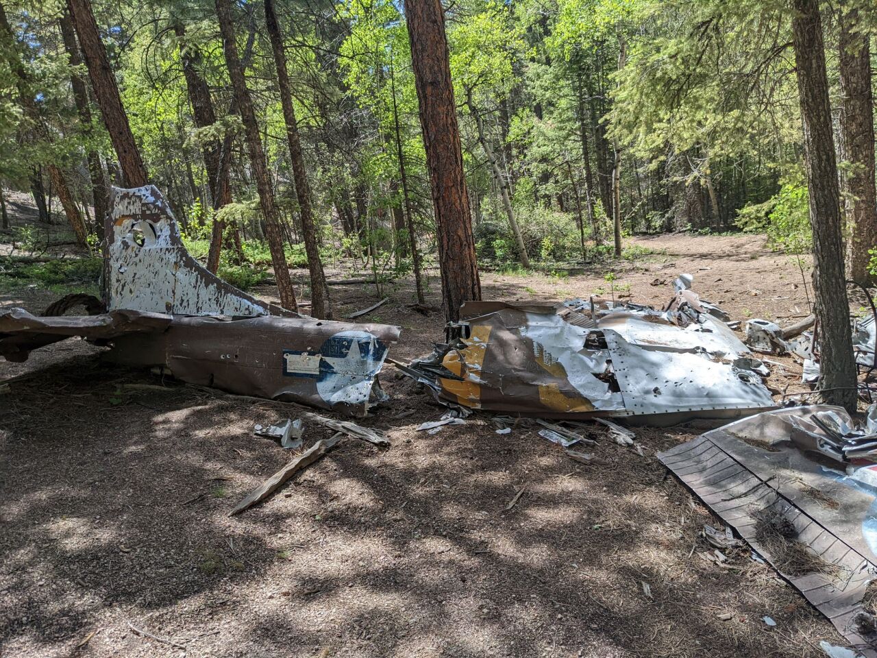
Oct. 12, 1957 | T-33 crash in Cheyenne Mountain State Park
During an attempted instrument approach to the Peterson Air Force Base runway amid fog, rain and 30 mph wind, two veterans in a single-engine Lockheed T-33A Shooting Star crashed into the southern shoulder of Cheyenne Mountain. It’s now within the borders of Cheyenne Mountain State Park.
Their last communication to control towers was a simple "We missed," and then the radio went silent, according to a sign at the crash site.

Pilot Lt. Col. Stevens H. Turner, who was a World War II veteran and experienced pilot, and co-pilot Capt. Roy V. Cook, a Korean war veteran and holder of the Distinguished Flying Cross, both died in the crash, according to the sign.
After multiple unsuccessful attempts — the terrain was rugged and wind was strong — the men's bodies were recovered two days later and flown out in a H-13 helicopter, according to the state park’s management plan. The wreckage was scattered across several hundred feet.

According to the investigation, the crash may have been caused by a failure to follow proper instrument approach procedures, pilot fatigue and haste, and poor conditions.
Known deaths: Stevens H. Turner (pilot), Roy V. Cook (co-pilot)
How to get to the site: Enter Cheyenne Mountain State Park from the southern end. From any nearby trail, make your way to the Talon Trail and continue onto the Dixon Trail. Continue up multiple switchbacks and the sign that prohibits equestrians and bicyclists to continue uphill. The crash is less than a mile beyond that sign. The map below indicates where to find the crash (look on the left side). Only hikers and others on foot are allowed up the Dixon Trail to the crash site. Dogs are not allowed in the majority of the park.

Sources: Cheyenne Mountain State Park Management Plan (2013), sign at the crash site, Friends of Cheyenne Mountain State Park
June 27, 1965 | T-33 crash off Bunce School Road
While few details are available about the T-33 crash in Allenspark from June 27, 1965, a single newspaper article from the following day offers some limited information, including the name of the two airmen who lost their lives.
The men were identified as Jay E. Currie and Donald B. Darby. On June 27, their T-33 veered off course, crashed, and burned in the mountains about 13 miles southwest of Lyons.

Both men were instructors with the Edwards Aerospace Research Pilot School in California. They were part of its Air Force Flight Test Center, where pilots are trained and new aircraft are tested, according to an article in the Fort Collins Coloradoan from the day after the crash.
The T-33 was developed from the Lockheed P-80 jet fighter, according to a sign at the site.

Known deaths: Jay E. Currie and Donald B. Darby
How to get to the site: Hop on Colorado Highway 72 and head toward Peaceful Valley. Park at the lot off of County Road 92/Forest Road 1141 (it's at a big U in the road). After passing through the campground, turn right into the parking lot to park or continue past the parking lot and make an immediate right onto County Road 105 (this turn is only 0.4 miles from Colorado Highway 72). Either hike or walk 0.9 miles up County Road 105 and make a sharp left. Cars with good clearance can continue, but toward the top, most vehicles will need to stop (ATVs are likely able to continue a bit farther). The site is about 2 miles from the turn off County Road 105. Click here for a map from AllTrails.
Sources: Fort Collins Coloradoan (June 28, 1965), sign at the site
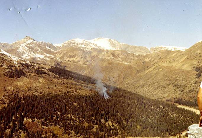
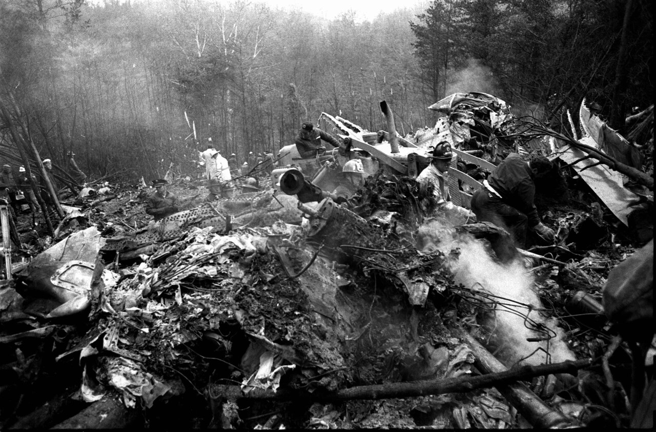
Oct. 2, 1970 | Wichita State crash near Loveland Pass
“I don’t know why we are alive right now."
That's what Wichita State University linebacker Glen Kostal, then-20 years old, said in the Oct. 3, 1970 edition of The Daily Sentinel.
It was one day after a plane carrying more than 30 people — mostly staff and players for the university's football team — slammed into the side of Mount Trelease along I-70 west of Silver Plume.
Kostal was one of the survivors and got away with a concussion and cuts on his head. The team had been headed to Logan, Utah for a Saturday game. They were split between two planes — a gold one and a black one, their school colors. Players, coaches, supporters and a few others were aboard.
Both pilots stopped in Denver on the sunny Friday afternoon of Oct. 2 to refuel. The pilot of the black plane detoured north to Wyoming to avoid the rugged Rockies while the pilot of the gold plane decided to take the scenic route by following I-70.
According to a witness who was driving on the interstate that afternoon, the plane flew over her car and attempted to land on the highway ahead of her, but then it made a 45-degree turn and exploded into the mountainside, according to the Oct. 3, 1970 Greeley Tribune. The final NTSB report detailed other witness accounts, who all claimed the plane was flying in the valley below the mountaintops along I-70, which was also confirmed by survivors.
Kostal recalled that the plane banked to the left and the uneasy passengers started asking what was going on. The aircraft then banked to the right and hit the mountainside around 1 p.m.
The impact threw passengers forward and to the left and dislodged their seats, and the plane split into pieces. Both wings broke off and shattered, the fuselage burned into molten aluminum, and the engines were separated from the propellers, according to the NTSB report.
Some passengers were able to escape through one of two holes — one in the left side of the fuselage and another on the right side of the cockpit. One survivor told the NTSB that many of the people who died at the scene actually survived the impact but perished in a subsequent explosion and fire.
The report also noted that the seats had hurtled forward and were found in a chaotic stack at the front of the plane, indicating the seats' tiedown mechanisms failed. This kind of failure "may make the difference in the survival or non-survival of occupants in an otherwise totally survivable accident," it read. It continued, saying "the failure of many occupants to evacuate must nevertheless be directly attributed to the seat failures as being the major injury producer."
In short, people were trapped under the loose seats or simple couldn’t climb over them to reach one of the two holes in the plane before the explosion.
According to WSU's website, Team Athletic Trainer Tom Reeves, who was badly burned, guided some survivors away from the crash and down the mountain, talking all the way, even bringing a small smile to some of their faces. He died a few days later.
For the remainder of the afternoon and evening, recovery crews walked up and down the mountainside carrying the remains of those who died in the crash, which totaled 29 by the end of the day, according to The Coloradoan on Oct. 4, 1970. The crews said the scene was still hot and smoking and it was “all but impossible to determine the identities of the remains,” which were transported to a morgue in Idaho Springs. Many were later identified by their dental records.
Meanwhile, officials brought heavy equipment into the mountains to try to remove the plane's engines to test for malfunctions.

Colorado State Patrol responded to the crash and once they helped the living get out of the wreckage and to a hospital, the agency stated that “there was no chance of other survivors among the 40 persons listed as passengers and crew on the twin-engine Martin 404.”
The WSU campus mourned the massive loss and flags across the state flew at half-staff. Twenty-nine people died at the scene and two people who were brought to a hospital later died of their injuries — John Taylor, who died 26 days later, and Reeves, the athletic trainer, who died a few days after the crash — bringing the death toll to 31. Of those 31, 14 were football players.
The six-day on-scene investigation following the crash found that the plane was registered to Jack Richards Aircraft Co. in Oklahoma City and the crew — three of four who died — was provided by Golden Eagle Aviation Co., according to The Coloradoan. Both pilots had their proper licenses and the planes had passed their previous inspections.
However, NTSB officials said the plane was an "aging airline" on its first passenger flight "coming out of mothballs," according to the Greeley Daily Tribune, and had been parked in storage for three years.
The plane weighed about 48,900 pounds after refueling in Denver, but its maximum takeoff weight was 44,900, meaning it was carrying at least two extra tons. The NTSB report later confirmed it was actually 5,190 pounds overweight at takeoff from Denver, and 2,665 pounds overweight when it crashed (the reduction was apparently from burning fuel).
A NTSB spokesperson said a few days after the crash that it appeared the plane flew into the canyon and was not able to regain altitude fast enough. Weather did not seem to be a factor.
“In a Denver hospital, co-pilot Ronald Skipper said the plane was flying a scenic sight-seeing route through the mountains but declined to discuss the details of the crash,” the Tribune reported on Oct. 5, 1970.
Within a week of the crash, NTSB had confirmed there was no mechanical failure and the plane had lacked a "valid safety certificate," according to The Coloradoan. In addition, the FAA found that the plane was not authorized for any passenger operations. The NTSB concluded that the probable cause was the pilot's error of flying the plane into a place it could not climb over, extra weight, absence of flight planning, and the crew's lack of understanding of the plane's limitations, according to its final report.
About a year later, the school continued grappling with the loss, but many avoided the subject altogether.
“There is an unspoken unity which ties the 1971 Wichita State University football team together," the Colorado Springs Gazette-Telegraph reported on Sept. 5, 1971. "Nobody talks about it openly; some purposely avoid discussing it. It is obvious to outsiders, however, that the tragedy which engulfed the squad and the school nearly a year ago has left a profound mark.”

The newspaper quoted the athletic director Cecil Coleman, who said the crash is "never mentioned."
"We just aren’t talking about it," he continued. "If people bring it up, we answer their questions. But as a rule, we just treat it as though it never happened. The feeling is nothing can be gained by dwelling on it.”
In December 1971, seven wrongful death actions were filed in U.S. District Court asking for more than $15 million in damages. These lawsuits, all filed by parents of the football players, brought the total number of actions filed in connection to the crash to 32. In total, they sought $42,880,000, according to the Greeley Daily Tribune.
Wichita State University has a page honoring the lives lost, titled "Remembering the 31."
Known deaths:
- Dan Crocker, 27 (pilot)
- Judy Lane, 28 (flight attendant)
- Judy Dunn, 39 (flight attendant)
- Randy Kiesau, 20
- Don Christian, 20
- Ron Johnson, 21
- Carl Krueger, 19
- Jack Vetter, 21
- Steve Moore, 21
- Marvin Brown, 19
- Tom Owen, 20
- John Duren, 19
- Richard Stines, 19
- Mal Kimmel, 21
- Tom Shedden, 20
- Gene Robinson, 21
- John Taylor, 21
- Ray King (Kansas State Representative)
- Yvonne King, 41
- Dr. Carl Fahrbach, 50 (dean of admissions)
- Martin Harrison, 19 (team equipment manager)
- Floyd Farmer, 35 (ticket manager)
- Ben Wilson, 44 (head football coach)
- Helen Wilson, 44
- John Grooms, 42 (had won the trip)
- Etta Mae Grooms, 38 (had won the trip)
- Ray Coleman, 45 (Shocker Club chairman)
- Maxine Coleman, 43
- Bert Katzenmeyer, 52 (athletic director)
- Marian Katzenmeyer, 52
- Tom Reeves, 31 (team athletic trainer)
How to get to the site: As you approach Loveland Pass on westbound I-70, keep an eye out for the roadside memorial plaque, which lists the names of the victims. It's near milepost 217. Take exit 216 and make a U-turn at the end of the road and follow it to the gate, where you can park. Follow the dirt access road for about 0.4 miles until you see a cairn on the left — it may be tricky to spot. Follow a social trail for another 0.4 miles southwest to the crash site. This second half is steep and rocky. Click here for a map from AllTrails.
Sources: Wichita State University website, The Daily Sentinel (Oct. 3, 1970 + Oct. 5, 1970), Greeley Daily Tribune (Oct. 3, 1970 + Oct. 7, 1970 + Dec. 10, 1971), The Coloradoan (Oct. 4, 1970 + Oct. 8, 1970), Colorado Springs Gazette-Telegraph (Sept. 5, 1971)
Dec. 14, 1971 | T-6 crash near Jasper Peak
United Airlines pilot Michael H. “Myke” Baar, a former ski star at the University of Denver, lived in the mountain town of Steamboat Springs with his wife and two children. He used an usual mode of transportation to commute between the Steamboat Springs airport and the one in Denver: his orange and white T-6 plane.
He held a position as a first officer on Boeing 727 aircrafts for United Airlines, according to The Steamboat Pilot.
On the afternoon of Dec. 14, 1971, Baar, who was 29 at the time, left the Denver airport after a day’s work.

However, the afternoon leaked into the evening with no word from him. Concerned, his wife alerted the local airport.
The initial search teams were faced with immediate challenges. A helicopter crew was forced to turn around due to heavy snow and wind. Officials at the airport couldn’t do much either, as Baar had not filed a flight plan, according to The Steamboat Pilot.
The search began in earnest the following morning, Dec. 15. But those teams weren’t the first to find him. Somewhat ironically, a United Airlines commercial plane flying over the area had picked up signals from a downed aircraft locator beacon, assumed to be Baar’s. The Steamboat Pilot reported that that sort of beacon can be turned on manually or automatically when a plane crashes and the signal will emit for about 48 hours in normal temperatures (somehow, the signal from Baar's plane was strong for about four days).
More high winds and blizzards hindered the search on Dec. 15, though officials had nearly pin-pointed the location of the crash by the end of the day. The search on Dec. 16 centered on Arapahoe Peak. The following day, they found the plane. It had crashed around 12,000 feet near the summit of Corona Pass and then slid down a rocky, wind-swept area.

“The plane was badly torn apart and almost completely buried in blown snow," The Steamboat Pilot reported. "It was extremely difficult to spot, but was identified by the registration number on the wing.”
Baar was still in the wreckage.
A physician at the scene said it appeared he had died instantly.
According to a report from the NTSB, the probable cause for the crash was listed as "improper in-flight decisions or planning."
The community mourned Baar's passing at a service held on Dec. 20 at United Methodist Church in Steamboat Springs. His family established a memorial section of books on aviation at an undisclosed library.
Known deaths: Michael H. “Myke” Baar
How to get to the site: Do not do this trail if you're unfamiliar with route-finding or using GPS coordinates. Park at the Fourth of July Trailhead and head northwest on Arapahoe Pass Trail. At about 1.2 miles, come to a split in the trail and take the left on the Diamond Lake Trail. Continue for about 0.4 to 0.5 miles before leaving the main trail to go into the basin where the crash is. Use a GPS to get to the crash, which is about 2.7 miles total for the trailhead. The coordinates are 40.000194, -105.674028. The crash is on the west side of a small, unnamed lake under Jasper Peak.
Sources: The Steamboat Pilot (Dec. 16, 1971 + Dec. 23, 1971 + Dec. 30, 1971)