


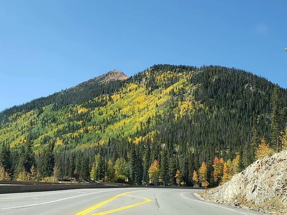
‘Tis the season for leaf peeping!
No matter if you’ve lived in Colorado your whole life or this is your first autumn here, watching the aspen leaves slowly turn from green to a brilliant gold is something special. Driving, hiking, running or biking in the glow of these trees can feel like an enchanted forest of sorts.
The leaves will start changing at different times throughout the late summer and autumn, depending on what region of the state they’re in. And those golden colors won’t stick around for long. Denver7’s Chief Meteorologist Mike Nelson created the below graphic to help you decide when to go to the mountains to see them for yourselves. He says the best time to make a trip to see the aspens is usually the final week of September.
The late spring melt and fairly gentle summer weather should bode well for the aspens this fall, Nelson said. The most brilliant display of aspens typically happens when Colorado has a mild late summer and periodic gentle rain with very few strong storms, Nelson said. These conditions may also lengthen the time the leaves are on the trees (which means more time for you to enjoy the views).
The aspen leaves turn from green to gold as sunlight decreases, which switches off the tree’s mechanism that creates chlorophyll, or the green color in the leaf. As the leaf dies, it turns to a brilliant yellow before fluttering to the ground, Nelson said.
While it may be tempting to try to bring this mountain magic to your Front Range yard, planting these trees at lower elevations is typically not successful. These delicate trees are suspectable to diseases and their root systems often grow into sewage drainage systems.
Now that you understand where the bright color comes from and how fleeting it is, you have a decision to make. Where will you go to see the changing aspens? With hundreds, if not thousands, of locations around Colorado that boast beautiful yellow aspens, it can be difficult to pick and choose where to spend your time. We’ve put together a list and interactive map of some of the top drives, hikes and train rides you can check out for all your fall foliage viewing.
Ready to go?
Note: Is your favorite spot not on this list? Want to include it? Send a picture, location information and any other details about the spot to OurCO@thedenverchannel.com, and we’ll include it in the “Recommended by Denver7 viewers” section below.
Top 10 drives
Kebler Pass
Start and end points: Crested Butte to Paonia
Drive time from Denver: 4 hours, 20 minutes
Notes: Also called Gunnison County Road 12, this road starts in Crested Butte, heads west, and ends near the south end of Paonia State Park east of Paonia. The high mountain pass takes drivers up to just over 10,000 feet, with stunning views of the landscape on both sides. This is a favorite location for leaf peeping. The pass is not paved.
Gold Camp Road
Start and end points: Colorado Springs to Victor
Drive time from Denver: 1 hour, 30 minutes
Notes: Fittingly named, the Gold Camp Road runs from west Colorado Springs to Victor. Beautiful views of the countryside and aspens will fill the curvy drive. There are plenty of places along the way to pull off the road to snap a few pictures. The road starts in Colorado Springs, but you’ll want to need to drive several miles west before you'll start to see aspens.
Gunnison County Road 3
Start and end points: South Carbondale to east of Crystal
Drive time from Denver: 4 hours, 50 minutes
Notes: Explore this road — which is a mix of pavement and dirt — by car or bike (or foot!). Also called the Road to Marble, this roadway is about 12 miles long from Evergreen Lane in south Carbondale to the split at Forest Road 317 through Marble and Crystal. Drive slowly here, especially on the rocky terrain and when passing traffic moving in the opposite direction.
Trail Ridge Road
Start and end points: Rocky Mountain National Park
Drive time from Denver: 1 hour, 45 minutes
Notes: If you’re willing to hang with the crowds, the 48-mile Trail Ridge Road will bring you — slowly — around this national park, in full view of the changing trees. There are plenty of places to pull off and explore the wilderness on foot. Even if you choose to stay in the comfort of a car, be sure you’re hydrating because the road climbs about 4,000 feet quickly.
Top of the Rockies Scenic Byway
Start and end points: Copper Mountain to Aspen
Drive time from Denver: 1 hour, 20 minutes
Notes: This byway, which hovers around 9,000 for several miles, has several spots along the way where you can get out to stretch your legs and explore the foliage. The byway is about 80 miles long, in total and takes drivers over Tennessee Pass.
Peak to Peak Scenic and Historic Byway
Start and end points: Boulder to Black Hawk
Drive time from Denver: Varies, depending on point of entry
Notes: This is Colorado’s oldest scenic byway (it was established in 1918!). It winds about 60 miles though national forests along the Front Range. There are multiple spots along the way — including Rocky Mountain National Park and Golden Gate Canyon State Park — where you can get out to see more golden aspens on foot.

San Juan Skyway
Start and end points: Ouray, Ridgway, Telluride, Rico, Dolores, Durango, Silverton
Drive time from Denver: 5 hours, 40 minutes
Notes: This 230-mile looped byway travels through multiple southwestern towns and the San Juan and Uncompahgre National Forests. Experts recommend spending at least two days soaking in the area and scenery.
Guanella Pass Scenic Byway
Start and end points: Georgetown to Grant
Drive time from Denver: 50 minutes
Notes: If you’re itching to see the changing aspens sooner than later, Guanella Pass is your go-to. The leaves usually start changing here earlier than other places. The new road makes the going easy for this drive — nice and smooth riding. If you want to stretch your legs, you can hop out to walk on the Bierstadt Trail (or go all the way to the summit, at 14,065 feet).

Poudre Canyon via Colorado Highway 14
Start and end points: Gould to the intersection of Colorado Highway 14 and Colorado Road 63E
Drive time from Denver: 2 hours
Notes: Head up to Fort Collins and then turn west to head toward the aspens! You’ll need to be a little patient as you wind your way west on Colorado 14, but you’ll be rewarded with the beautiful views once you pass Colorado Road 63E on your left. If you want to spend more time up here, there are plenty of hiking trails and campgrounds along the way.
Highway 103 + Mount Evans Road
Start and end points: Get on Highway 103 from Idaho Springs or the Squaw Mountain area
Drive time from Denver: 40 minutes
Notes: Want to see beautiful aspens and breathtaking views in one go? Jump on Highway 103 and take it to the Mount Evans Road, which starts at Echo Lake. Enjoy the drive in the yellow leaves before you start climbing, leave the colorful leaves behind and trade them in for skyscraping views from the top of Mount Evans.
Top 10 hikes
Fourth of July Trailhead/Hessie Trailhead (Nederland)
Trailhead: West of Nederland and Eldora
Length: Multiple lengths
Drive time from Denver: 1 hour, 20 min
Fee: None
Notes: From the trailhead, ascend into the Indian Peaks Wilderness Area, which is filled with aspens. Parking at this split trailhead fills quickly on the weekends, so come early or take the free shuttle from Nederland Park and Ride to the trailhead.
Jud Wiebe Trail (Telluride)
Trailhead: Northern end of N. Aspen Street or northern end of N. Oaks Street
Length: 2.6 miles
Drive time from Denver: 6 hours, 10 minutes
Fee: None
Notes: This trail provides a beautiful view of Telluride while taking hikers up through aspen and spruce forests to an open meadow. It’s a heavily used trail.
Booth Creek Falls (Vail)
Trailhead: Northern end of Booth Falls Road
Length: Multiple lengths (to get to the waterfall and back is about 4 miles)
Drive time from Denver: 1 hour, 40 minutes
Notes: Parking is limited, so you can take the free Town of Vail bus from the Vail Village parking structure to the trailhead. This trail starts climbing immediately, but offers plenty of places to sit at the waterfall.
Golden Gate Canyon State Park (Golden)
Trailhead: Multiple entry points
Length: Multiple trails
Drive time from Denver: 1 hour
Fee: Daily pass is $8 unless you have a state park pass
Notes: Just about 30 miles away from Denver, this state park offers many different trails — both long and short — for visitors. Enjoy the aspens during the climbs, downhills and open fields.

Staunton State Park (Pine)
Trailhead: Take S. Elk Creek Road (Elk Creek Road exit) north off Highway 285 and continue about 1.5 miles to the park entrance on the right.
Length: Multiple trails
Drive time from Denver: 45 minutes
Fee: Daily pass is $8 unless you have a state park pass
Notes: Don’t want to drive too far to see the changing aspens? Staunton State Park, at just 45 minutes away from downtown Denver, offers the best of both worlds: short drive, beautiful fall foliage! Some of the trails in the park are rugged, so be prepared for some long uphills and rocky terrain.
Spring Creek Road and Trail (Steamboat Springs)
Trailhead: Corner of Amethyst Drive and E. Maple Street
Length: A little more than 10 miles roundtrip (it’s an out-and-back trail, so turn around early if you want to shorten the hike)
Drive time from Denver: About 2 hours, 45 minutes
Fee: None
Notes: This moderate trail starts at the intersection and heads west. It boasts beautiful wild flowers in the summer that leads to the changing aspen colors come autumn. There are some benches along the first section that are shaded if you need a break to enjoy the scenery. Park before you reach the ponds on the left. It starts as a dirt road and leads into a trail.
Kenosha Pass (Jefferson)
Trailhead: Forest Road 849 off of US Highway 285
Length: Multiple lengths along the Colorado Trail
Drive time from Denver: 1 hour, 15 minutes
Fee: None
Notes: If you can grab a parking spot at Kenosha Pass (go early!), you can spend many miles hiking on the Colorado Trail in the glow of the yellow aspens. Bathrooms are available on the southern side of the trail. The trail is split by the highway, so use extra caution when crossing. This area gets very congested on weekends during peak leaf peeping season.

Dyke Trail (Gunnison)
Length: 13.9-mile loop
Drive time from Denver: 4 hours, 50 minutes
Fee: None
Notes: If you’re willing to work hard for it, this trail will reward you with spectacular views. It’s a climb that dumps you out around 10,500 feet. Be prepared for single-track, technical downhills, a few small water crossings and beautiful views of the mountains, sprinkled in yellow splotches of aspen groves.
Argentine Central Railroad Grade (Silver Plume)
Trailhead: Take exit 226 off I-70, look for the hiking sign and turn onto Mountain Street heading east. It ends at the trailhead.
Length: Up to 13 miles one way
Drive time from Denver: 50 minutes
Fee: None
Notes: This trail takes users from Silver Plume toward, but not to, Grays and Torreys Peaks. It’s a long steady uphill, but is an out-and-back trail, so hikers can turn around at any point. The trail runs through many aspen groves. Keep an ear out for the nearby Georgetown Loop Railroad.
Butler Gulch trail (Clear Creek County)
Trailhead: Butler Gulch Trailhead
Length: 5 miles out and back
Drive time from Denver: 1 hour
Fee: None
Notes: Find parking at the trailhead or the nearby Henderson Mine facility and then head south on Butler Gulch Trail. You’re just barely an hour outside of Denver, but it will feel like a total mountain experience with miles-long views, waterfalls, aspens (of course!) and more. If you want to check this out during peak leaf-changing season, leave early. The parking lot fills up fast on weekends.
Take a train ride instead
If you’d rather relax to the max, but enjoy the fall foliage just as much, there are multiple trains that weave their way through the mountains, giving you beautiful views from the comfort of a train car.
Cumbreas & Toltec Scenic Railroad
Start and end locations: Antonito, Colorado to Chama, New Mexico
Fee: $20.50-$27.50 (price may change)
Notes: This train run daily until Oct. 20. If you want a train ride specifically catered toward the changing leaves, look into hopping aboard this railroad’s Fall Colors Explorer Train, which runs from Sept. 9 to Oct. 12.
Georgetown Loop Railroad
Start and end locations: Georgetown and Silver Plume
Fee: $30-$40 (price may change)
Notes: This railroad has two options catered toward leaf peeping: The Fall Colors Train and the Fall Colors Express.
Leadville Colorado & Southern Railroad
Start and end locations: Leadville and Climax
Fee: $22-$86 (price may change)
Notes: Take a trip around the Continental Divide and San Isabel National Forest. Roundtrips are 2.5 hours long. Trips are offered through the week at 1 p.m. with rides catered toward photographers at 10 a.m. and 2 p.m. on the weekends.
Cripple Creek and Victor Narrow Gauge Railroad
Start and end locations: Cripple Creek and Victor
Fee: $50-$205 (price may change)
Notes: This ride, which is narrated with information on the area, takes visitors four miles in 45 minutes, including stops along the way. The train runs every 40 minutes from 10 a.m. to 5 p.m. and is pet friendly.
Durango and Silverton Train
Start and end locations: Durango and Silverton
Fee: $60-$224 (price may change)
Notes: Hitch a ride on this train above the Animas River and enjoy the fall colors from the train car. Day hikers are welcome to use the train to get to the mid-route stop, and then hop off to explore the San Juan National Forest and Weminuche Wilderness.
Recommended by Denver7 viewers
Have you been to a place that you think deserves to be on this list? Send a picture, location information and any other details about the spot to OurCO@thedenverchannel.com. We'll include it below. And want to see more Colorado photos? Join the Our Colorado photography Facebook group at www.Facebook.com/groups/OurCO.
Maroon Bells (photograph by Icelita Choi | Sept. 22, 2019)

Boreas Pass (photograph by Kelly Kirchmar-Heger | Sept. 23, 2019)

Grand Lake (photograph by Lottie Wilson | Sept. 22, 2019)

Alberta Falls at Rocky Mountain National Park (photograph by Natalie Greene | Sept. 21, 2019)

Highway 24 near Minturn (photograph by Daniel Forster | Sept. 23, 2019)

Frasier (photograph by James G. Bennett | Sept. 26, 2019)

Winter Park (photograph by Miranda Prusik | Sept. 26, 2019)

Country road near Ridgway (photograph by Malachi Lewis | Sept. 26, 2019)

