


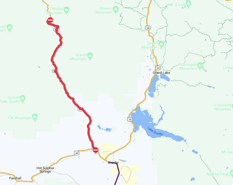
UPDATE: Highway 125 between Highway 40 and Willow Creek Pass reopened Thursday around 3:45 p.m.
...
A flash flood warning is in place for the burn scars of the East Troublesome Fire and Cameron Peak Fire Tuesday as storms roll through the area.
The National Weather Service said these two warnings were issued around 1:30 p.m. after a doppler radar showed a thunderstorm with heavy rain moving into the burned scars from the 2020 wildfires.
The warning in north-central Grand County included Stillwater Pass, Upper Willow Creek Valley, Middle Willow Creek Valley and Lower Willow Creek Valley, plus much of the 193,812-acre East Troublesome Fire burn scar. This heavy rainfall will cause flash flooding in small creeks, streams and ditches, the NWS said. Rock slides and debris flows may also occur on rural roads.
The map below shows this warning.
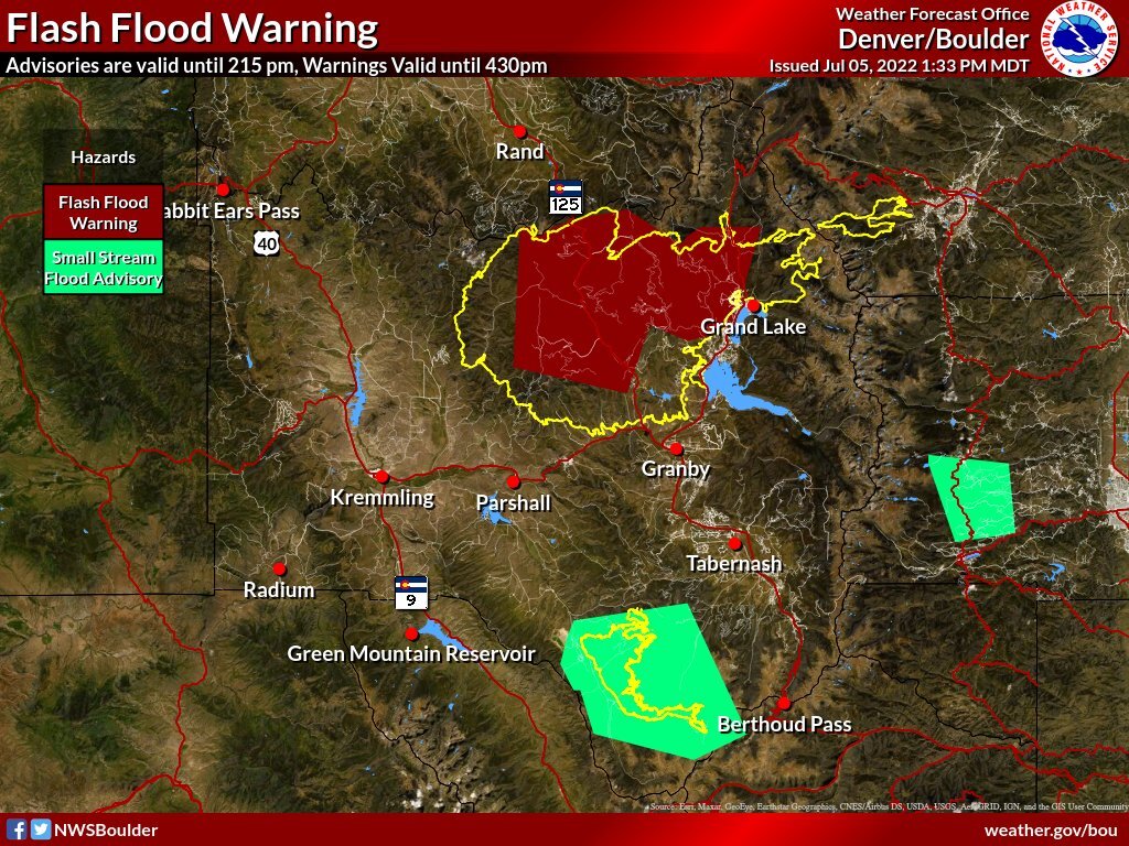
Since 1:30 p.m., about 0.5 inches of rain had been measured in the area. Flash flooding is either already happening or will begin soon, the NWS said.
Colorado Highway 125 closed in both directions around 3:40 p.m. between the turn off from Highway 40 and Willow Creek Pass due to a mud slide. The road is only open to locals. A map of that closure is below.
This warning ends at 4:30 p.m.
The second warning in south-central Larimer County was issued a few minutes after the one in Grand County.
This warning is expected to expire around 4:45 p.m. Until then, it is affecting Stringtown Gulch, Crystal Mountain, The Retreat, Storm Mountain and Rocky Mountain National Park. Glen Haven, Drake and southeast parts of the Cameron Peak Fire burn scar may see flash flooding of small creeks and streams, gulches and low-lying areas, the NWS reported.
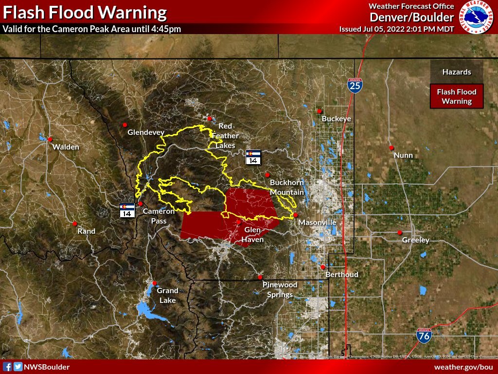
This also includes the following waterways: Big Thompson River, Pennock Creek, Cow Creek, Sheep Creek, Solitude Creek, Grouse Creek, Eld Creek, Black Creek, Dry Creek, North Fork Big Thompson River, Glacier Creek, Cedar Creek, Buckhorn Creek, Miller Fork, North Fork Fish Creek and North Fork Little Thompson River.
In addition to these two flash flood warnings, a small stream flood advisory is affecting the entirety of the 14,833-acre Williams Fork Fire, plus the surrounding area (this is west of Berthoud Pass in the map above), until 2:30 p.m. Tuesday. This fire also burned in 2020.
Precipitable water will rise to between 0.6 and 0.9 inches in the high country and 1.10 inches near the foothills, according to the NWS.
The storms will grow in strength as they move over the plains.
The NWS is reminding people to avoid walking or driving through flood waters and, when necessary, to seek higher ground.
Looking ahead, the NWS has predicted that Wednesday will bring more storms and showers that could result in flash flooding over burn scars.
